Map seabed character, debris, objects, construction features and route constraints with project-selected sonar.
SEABED · SUBSURFACE · TARGET INTELLIGENCE
Geophysical survey
services.
See beyond the surface.
Ven-Tech delivers Geophysical Survey Services across Canada using side-scan sonar, sub-bottom profiling, magnetometer systems, bathymetry and targeted investigation for engineering, infrastructure and environmental decisions.
SSSSeabed imagery
SBPSubsurface profiles
MAGAnomaly detection
Surface, seabed and subsurface
One survey.
Connected evidence.
Professional Geophysical Survey Services turn acoustic, magnetic and positioned observations into defensible project intelligence.
Ven-Tech begins with the client’s decision: locate a route, screen a construction footprint, identify potential hazards, understand shallow stratigraphy, map seabed features or investigate a known anomaly. That purpose defines sensor selection, platform, line spacing, speed, altitude, positioning, control and acceptance criteria.
Side-scan sonar records seabed texture and suitable objects. Sub-bottom profilers image shallow reflectors beneath the seabed. Magnetometers and gradiometers detect suitable ferrous anomalies. Bathymetry provides terrain and depth context. When one signature is not enough, ROV video, imaging sonar, laser scaling or direct inspection can strengthen the interpretation.
The final record preserves how each observation was acquired, processed and interpreted. Results include the relevant coordinate reference, data quality, target confidence, assumptions and limitations—because a colourful mosaic or profile is useful only when the project team understands what it can support.
Sensor-integrated acquisitionLive field quality controlEngineering-ready outputs
Build stratigraphic context and screen suitable buried features with controlled profiling and interpretation.
Measure magnetic response with suitable tow geometry, positioning, altitude control and background correction.
Integrate bathymetry and spatial control so targets and profiles make sense within the actual site geometry.
Geophysical Survey Services capabilities
Map what is visible.
Resolve what is hidden.
Ven-Tech combines complementary sensors so Geophysical Survey Services can address seabed, subsurface, anomaly and terrain questions without treating one instrument as the answer to every site.
 01↗
01↗Side-scan sonar imaging
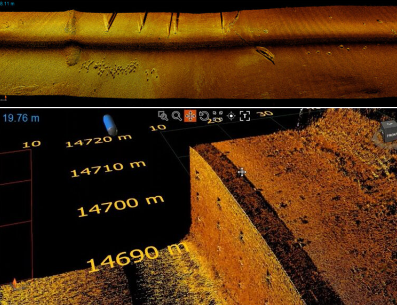
Create high-contrast acoustic imagery of the seabed for object detection, debris searches, route reconnaissance, habitat context and target classification. Line spacing, range and frequency are selected around the minimum target and required coverage.
Explore capability →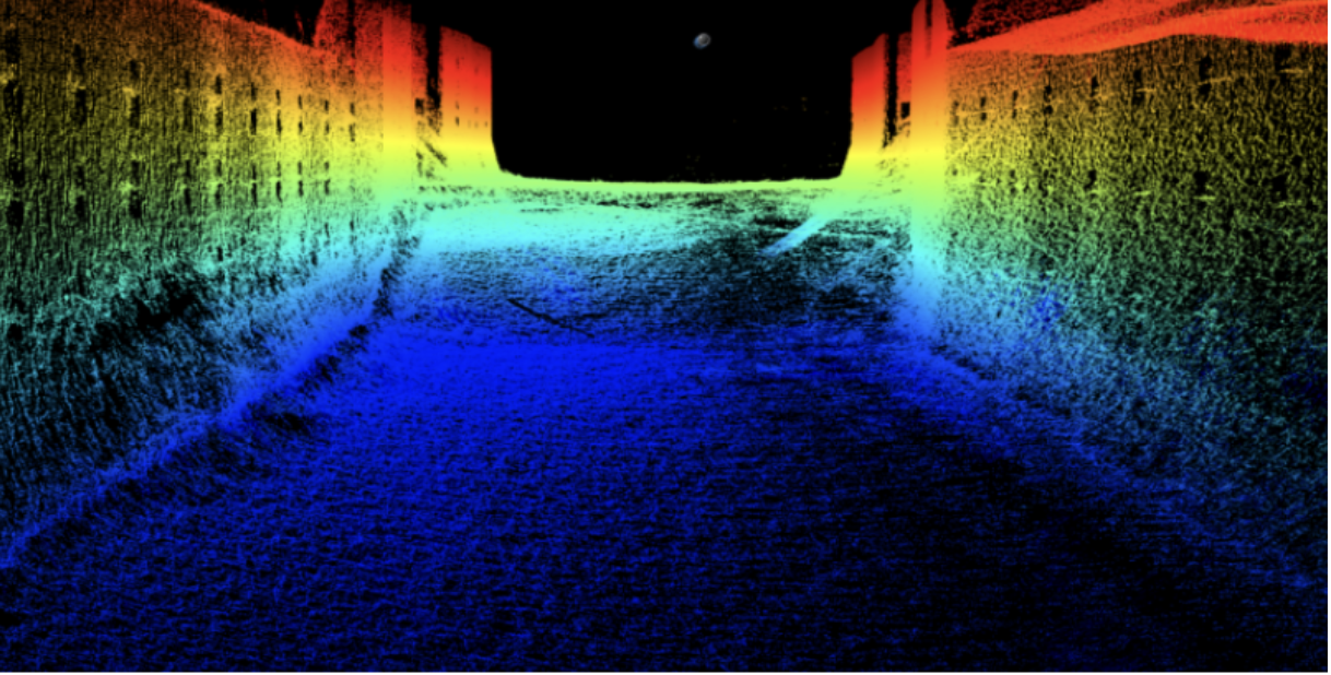 02↗
02↗Sub-bottom profiling
Image shallow subsurface reflectors to support sediment interpretation, burial assessment, stratigraphic context and route planning. The source, frequency, tow geometry and processing approach are matched to penetration and resolution objectives.
Explore capability →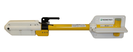 03↗
03↗Magnetometer & gradiometer
Detect and map suitable ferrous anomalies associated with buried infrastructure, debris, unexploded-ordnance screening targets and other magnetic sources. Results are interpreted with position, altitude, background field and survey geometry.
Explore capability →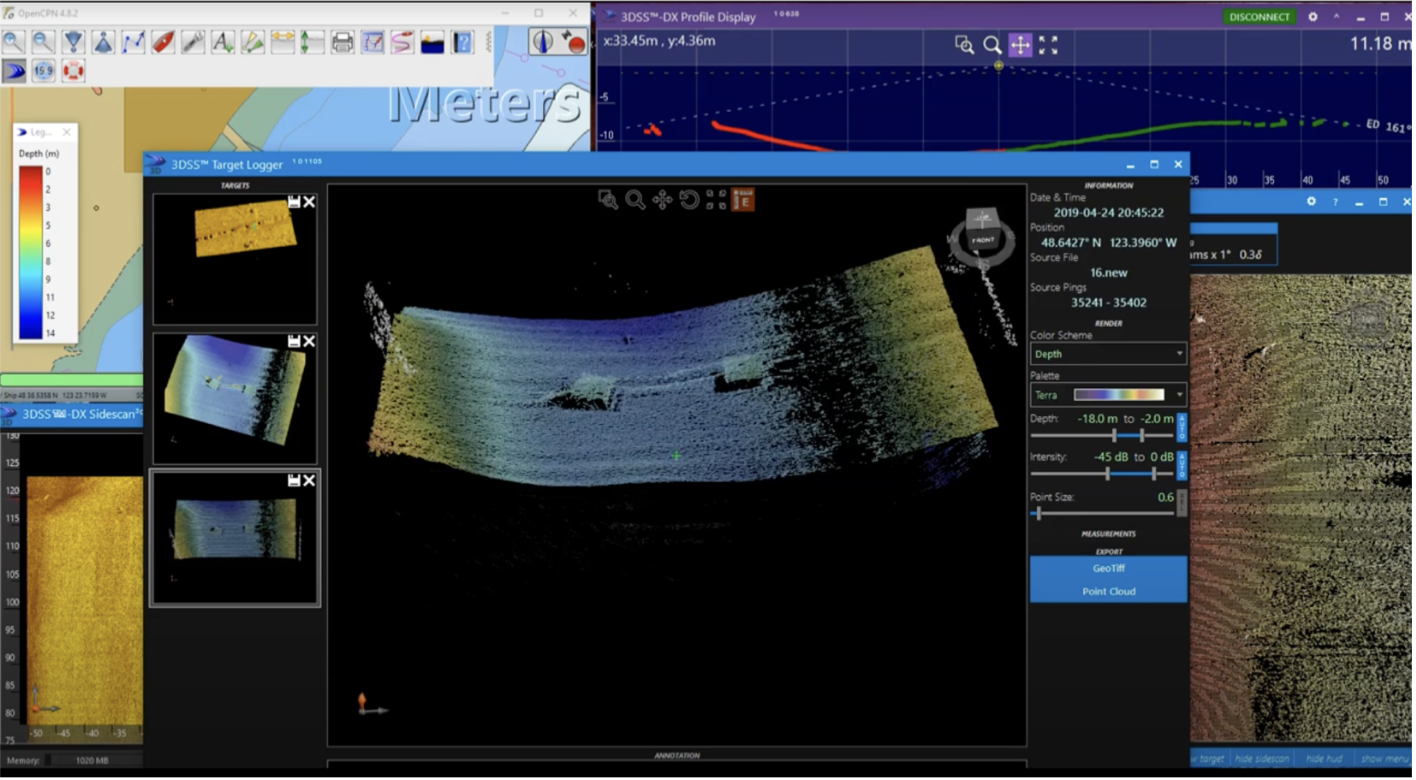 04↗
04↗Bathymetry & seabed models
Combine geophysical acquisition with positioned depth data to build terrain context, contours, digital elevation models and surfaces for engineering, construction, environmental and asset-management programs.
Explore capability →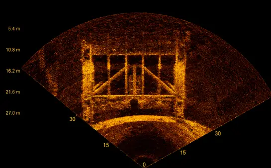 05↗
05↗Target investigation
Reacquire anomalies with higher-resolution sonar, ROV video, imaging sonar or direct inspection when the project needs stronger identification, dimensions, condition context or clearance decisions.
Explore capability →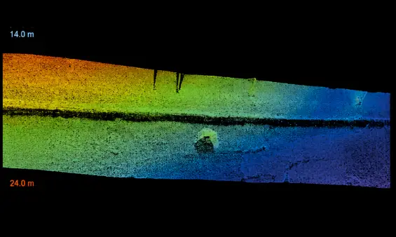 06↗
06↗Route & clearance surveys
Integrate side-scan, sub-bottom, magnetics and bathymetry for cable, pipeline, intake, outfall, crossing, dredging and construction corridors. One coordinated dataset reduces gaps between surface, seabed and subsurface evidence.
Explore capability →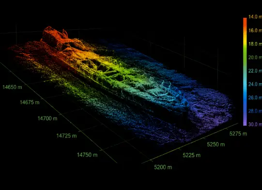
Multi-sensor correlation
See the seabed.
Read below it.
Geophysical Survey Services become more useful when a target’s acoustic shape, magnetic response, depth, subsurface context and verification record can be reviewed together.
- 01 Define detection and interpretation objectives
- 02 Correlate complementary sensor signatures
- 03 Reacquire uncertain or priority targets
- 04 Preserve confidence and limitations
Platforms, sensors & processing
Configure the system.
Control the evidence.
Geophysical Survey Services can be deployed by vessel, USV or ROV according to depth, access, sea state, line length, sensor payload, positioning and the final data requirement.
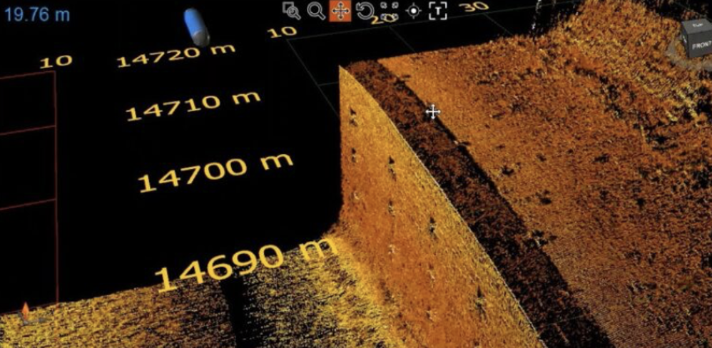 01
01RANGE / ENDURANCE
Crewed survey vessels
Stable work platforms for longer lines, offshore or exposed sites, higher payloads and integrated navigation, sonar, profiling and magnetic systems. Vessel configuration follows draft, access, sea state and survey-control requirements.
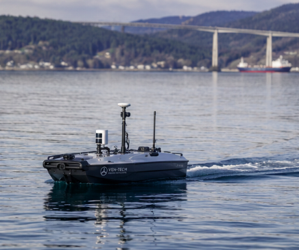 02
02SHALLOW / REMOTE
Unmanned surface vessels
Compact USVs support repeatable line keeping and reduced personnel exposure in suitable reservoirs, nearshore areas, ports and constrained waters. Payload, endurance, communications and recovery planning are confirmed for each site.
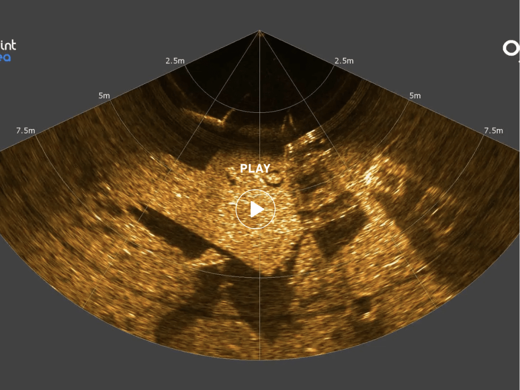 03
03CLOSE RANGE / VISUAL
ROV target verification
ROVs can investigate selected anomalies using video, imaging sonar, laser scaling and mission-specific sensors. This closes the gap between a remote geophysical signature and a practical asset or hazard observation.
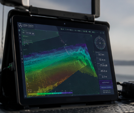 04
04QA/QC / INTERPRETATION
Integrated processing
Navigation, sensor records and field logs are reviewed together before mosaics, profiles, magnetic products, target registers and GIS or CAD deliverables are issued with stated assumptions and limitations.
Six-stage survey workflow
Plan the lines.
Verify the result.
Geophysical Survey Services are strongest when scope, field control and interpretation remain connected. Ven-Tech uses a defined workflow from the first project question through the final target register and report.
Discuss your survey scope ↗Start with the decision
Confirm the survey purpose, area, target size, penetration or detection objective, required confidence, reference system, acceptance criteria, schedule and deliverable formats.
Build the survey basis
Compile drawings, charts, previous surveys, geotechnical information, known services, site access, water depths, expected geology, environmental constraints and known hazards.
Match sensors to the question
Select sonar frequency and range, sub-bottom source, magnetic configuration, line spacing, altitude, platform, positioning, control, speed and cross lines for the required evidence.
Prepare safe execution
Document vessel or USV operations, launch and recovery, traffic, exclusion zones, communications, weather, equipment checks, emergency provisions, data-security needs and stop-work limits.
Quality-control in the field
Monitor navigation, altitude, tow position, overlap, line keeping, signal quality, noise, dropouts and target coverage. Repeat questionable lines while the team is still mobilized.
Deliver traceable results
Process the agreed datasets, correlate targets across sensors, classify confidence, document limitations and issue the maps, profiles, surfaces, registers and technical report required by the project.
Geophysical survey deliverables
From field signals
to usable decisions.
Geophysical Survey Services deliverables are defined before mobilization so acquisition density, references, processing and interpretation support the intended engineering, environmental, construction or investigation use.
Side-scan mosaics
Georeferenced acoustic mosaics with coverage, resolution, range, processing and presentation documented.
Target register
Coordinates, dimensions, confidence, source imagery, interpretation and recommended investigation for detected features.
Sub-bottom sections
Processed profiles and selected interpretation showing suitable reflectors, sediment structure and buried features.
Magnetic products
Corrected profiles, anomaly maps, analytic products and selected targets with acquisition geometry and limitations stated.
Bathymetric surfaces
Positioned soundings, gridded models, contours, shaded relief and project-selected profiles or clearances.
Route corridor package
Integrated alignment sheets, constraints, targets, crossings, seabed and subsurface context for design review.
GIS & CAD files
Agreed raster, vector, point, surface and tabular formats prepared for engineering and asset systems.
Technical report
Scope, equipment, method, control, quality checks, results, interpretation, limitations and deliverable index.
About Ven-Tech Subsea
Advanced systems.
Field-proven people.
The About Ven-Tech film introduces the integrated survey, robotics, diving, reservoir and inspection teams behind complex infrastructure work across Canada.
ABOUT VEN-TECH / 2025
One accountable project team
See the people, equipment and operating disciplines that connect survey design, field acquisition, anomaly investigation and client-ready reporting.
Learn more about Ven-Tech ↗Standards, quality & interpretation
Use the right standard
for the right decision.
Geophysical Survey Services acceptance begins with a project-specific specification.
The current IHO S-44 Edition 6.2.0 applies to hydrographic surveys and provides a flexible specification matrix. It also states that standards for surveys conducted for purposes such as geophysical, oil and gas, dredging and geotechnical work are not defined by S-44 alone. Ven-Tech therefore confirms the client, engineering, regulator and contract requirements that apply to each dataset.
Navigation, tow position, layback, altitude, line spacing, cross lines, sensor calibration, background corrections, processing and interpretation all affect the final confidence. The report identifies the method, quality checks, target criteria and known limitations instead of implying certainty that the data cannot support.
Survey specification
Define intended use, target size, coverage, penetration, detection confidence, references and acceptance before fieldwork.
Navigation & geometry
Control sensor position, offsets, layback, altitude, speed, heading, line spacing and cross-line verification.
Field QA/QC
Review coverage, noise, signal quality, dropouts, line keeping and target reacquisition while corrective work is practical.
Interpretation control
Correlate available sensors, classify confidence and preserve assumptions, alternatives and limitations in the final record.
HSE · QUALITY · OPERATIONAL CONTROL
Remote acquisition.
Accountable execution.
Survey technology does not replace safe marine operations. Ven-Tech plans vessel or USV launch and recovery, traffic, weather, electrical and mechanical hazards, tow bodies, exclusion zones, communications, environmental controls, emergency arrangements and stop-work criteria around the actual site.
BCCSA COR® CertifiedISNetworld Member ContractorISNetworld ESG BadgeAvetta ApprovedCognibox CertifiedAlcumus SafeContractorProject-specific survey plansLive field data QA/QCTraceable interpretationCHS / IHO scope reviewUSV / ROV / vessel integrationATHENA™ operational framework
Where geophysics adds value
Complex ground.
Clearer decisions.
Professional Geophysical Survey Services support organizations responsible for submerged infrastructure, marine construction, energy corridors, navigation, environmental performance and public safety.
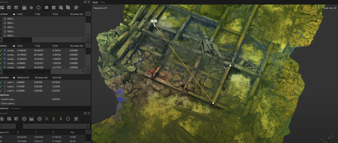
01Cable and pipeline route surveys↗
02Ports, harbours and marine terminals↗
03Dams, reservoirs and hydropower↗
04Dredging and marine construction↗
05Intakes, outfalls and crossings↗
06UXO and ferrous-target screening↗
07Environmental and habitat programs↗
08Offshore energy and subsea assets↗
Geophysical Survey Services FAQ
Plan the survey
with confidence.
These answers are a practical starting point. Ven-Tech confirms the sensors, platform, survey geometry, HSE controls, acceptance criteria and deliverables for the actual site.
What are Geophysical Survey Services used for?+
Geophysical Survey Services map seabed texture, subsurface reflectors, magnetic anomalies, water depth and potential targets for marine construction, cable and pipeline routes, dredging, ports, environmental work, hazard screening and underwater asset programs. The sensors and line plan are selected around the decision the data must support.
What is the difference between side-scan sonar and multibeam sonar?+
Side-scan sonar is optimized for acoustic imagery and seabed or object detection across a swath. Multibeam echosounders collect positioned depth observations used to produce bathymetric surfaces and point clouds. They can be collected together because a target image and a depth model answer different questions.
What does a sub-bottom profiler show?+
A sub-bottom profiler records acoustic reflections beneath the seabed. Suitable systems can show sediment layering, buried channels, interfaces and some buried objects. Penetration and resolution depend on source frequency, geology, sediment, water depth, noise, tow geometry, processing and the target itself.
Can a magnetometer identify unexploded ordnance?+
A magnetometer can detect suitable ferrous anomalies, but a magnetic response alone does not prove identity. UXO-related programs require an approved project methodology, qualified interpretation, appropriate survey geometry and a defined investigation or clearance process. Ven-Tech reports anomaly confidence and limitations without overstating classification.
Can the survey be completed from an unmanned surface vessel?+
Yes, when depth, sea state, traffic, communications, endurance, sensor payload, positioning and safe launch and recovery make a USV appropriate. Other sites require a crewed vessel, ROV or combined platform plan. The project team selects the platform after reviewing the operating environment and data objective.
Do Geophysical Survey Services follow IHO S-44?+
Not automatically. IHO S-44 defines standards for hydrographic surveys, and its current specification matrix can help task and assess some related data. It also notes that standards for geophysical, oil and gas, dredging and geotechnical surveys are not defined by S-44 alone. Ven-Tech confirms the client, regulator and project specifications that actually apply.
What deliverables can Ven-Tech provide?+
Depending on scope, deliverables can include side-scan mosaics, target registers, waterfall records, sub-bottom profiles and interpretation, magnetic profiles and anomaly maps, bathymetric surfaces, contours, route sheets, GIS or CAD files, imagery, field logs and a technical report with methods, quality checks and limitations.
What information is needed for a proposal?+
Provide the survey purpose, area or route, water depths, required target size, penetration or detection objective, known hazards, previous data, access, schedule, coordinate and vertical reference, accuracy or acceptance criteria, intended use and required formats. Early confirmation prevents a visually impressive dataset that cannot support the final decision.
Start with the project question
Need to understand
what lies below?
Send the site, route or survey limits, water depths, known hazards, target size, penetration or detection objective, existing information, schedule, required reference system and final deliverables. Ven-Tech will help define a practical Geophysical Survey Services approach.