
Review spatial relationships instead of interpreting isolated images with no shared geometry.
IMAGE-BASED MODELLING · DIGITAL TWINS · CHANGE
3D Photogrammetry.
Inspect once. Explore repeatedly.
Ven-Tech delivers 3D Photogrammetry across Canada for underwater assets, industrial infrastructure, confined spaces, aerial mapping and measurable digital records.
3DTextured models
SfMOverlapping imagery
QAVerified control
From images to spatial evidence
See the condition.
Understand the geometry.
Professional 3D Photogrammetry turns deliberate image capture into a navigable, measurable and shareable asset record.
Ven-Tech begins with the decision the model must support. Condition visualization, dimensions, change analysis, volume calculations, digital-twin collaboration and presentation each require different capture geometry, scale, control, processing and validation.
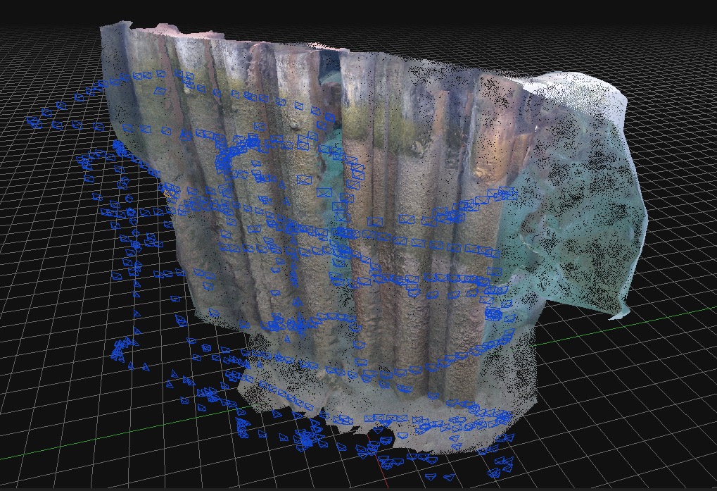
ROVs, confined-space drones, UAS and controlled cameras collect overlapping images from multiple viewpoints. Processing identifies common features, estimates camera positions and reconstructs point, surface and textured model products. Project-selected scale bars, known dimensions, survey control or positioning constrain the model where measurements or reference systems are required.
Photogrammetry is not suitable in every environment. Turbidity, glare, featureless surfaces, motion, poor lighting and inaccessible viewpoints can create gaps or uncertainty. Ven-Tech assesses those limits before capture and can combine optical models with sonar, LiDAR, hydrographic data or direct inspection.
Mission-designed image captureScale and control verificationEngineering-ready formats
Support selected dimensions, areas, profiles and volumes when control and quality meet the objective.
Use consistent future capture to review selected changes in geometry, condition or construction status.
Give engineers, owners and maintenance personnel a navigable record for remote collaboration.
3D Photogrammetry capabilities
Capture the asset.
Keep the context.
Ven-Tech configures 3D Photogrammetry around visibility, geometry, access, required measurements and deliverables—then adds complementary sensors when imagery alone cannot answer the question.
 01↗
01↗Measurable digital twins
Convert suitable overlapping imagery into a textured, scaled 3D representation of an asset or environment. Models give engineering and maintenance teams a permanent spatial record that can be revisited after demobilization.
Explore capability →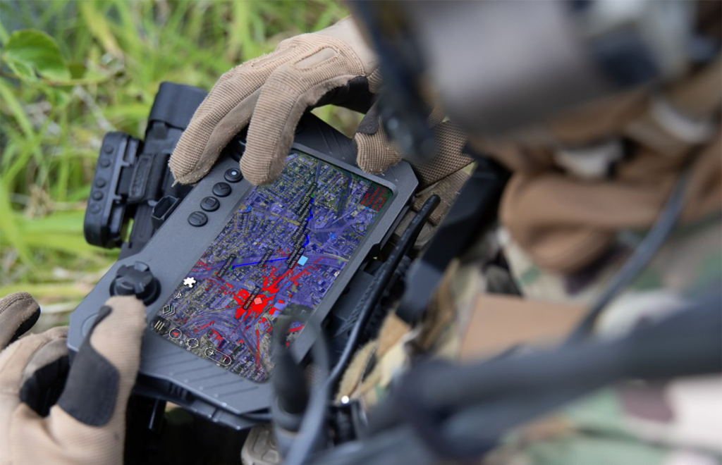 02↗
02↗Structural condition mapping
Place corrosion, cracking, deformation, coating loss, marine growth, impact damage and other visible observations within the model instead of separating findings across unrelated photographs.
Explore capability →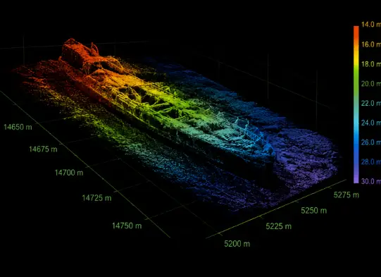 03↗
03↗Measurements & geometry
Support suitable distance, area, profile, alignment and volume measurements when scale, control, image quality and processing meet the project objective. Accuracy is verified against the agreed method—not assumed from the software.
Explore capability →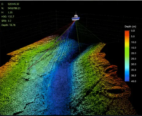 04↗
04↗Baseline & change comparison
Create repeatable baseline records and compare later models to review selected geometry, sediment, scour, damage progression, construction status or maintenance outcomes where acquisition is sufficiently consistent.
Explore capability →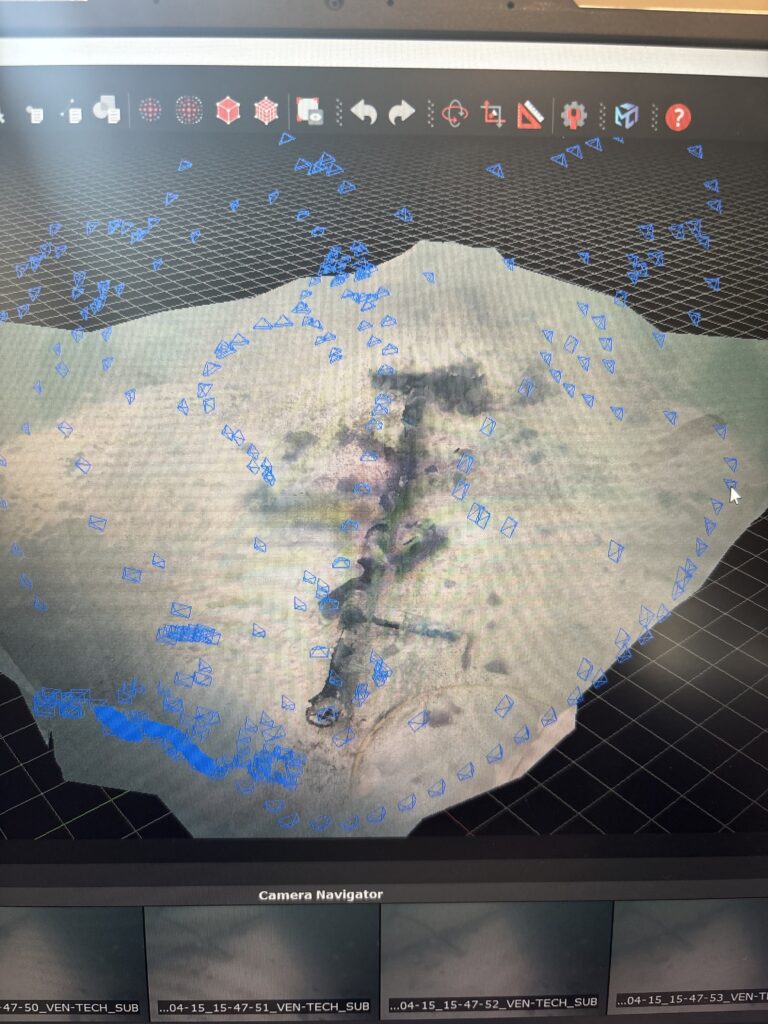 05↗
05↗Remote & confined acquisition
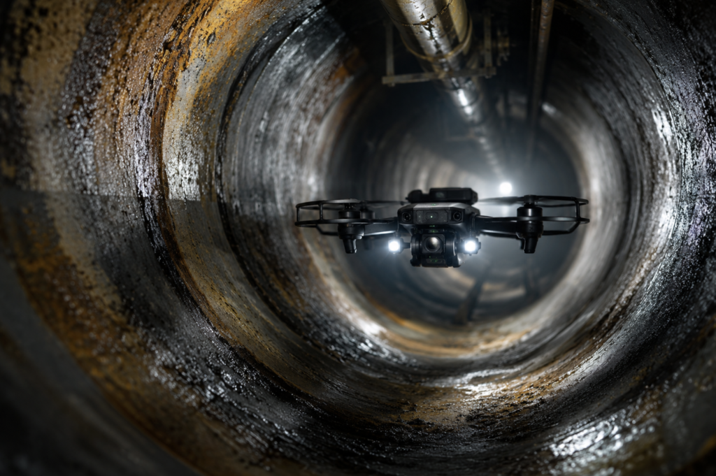
ROVs, collision-tolerant drones, UAS and controlled camera systems can collect imagery in underwater, interior, elevated or hazardous locations where access, lighting, visibility and surface texture support reconstruction.
Explore capability →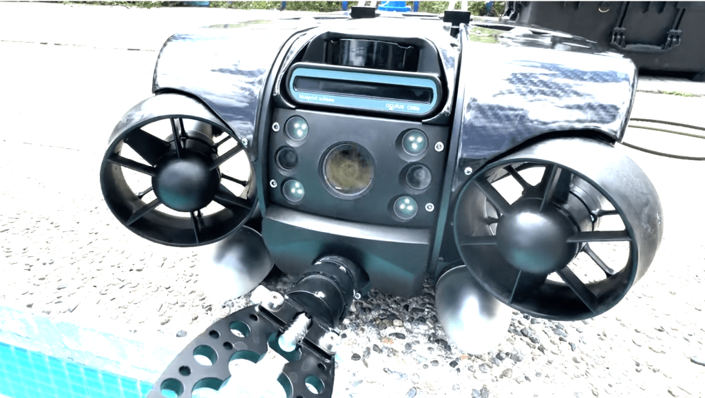 06↗
06↗Pipelines & linear assets
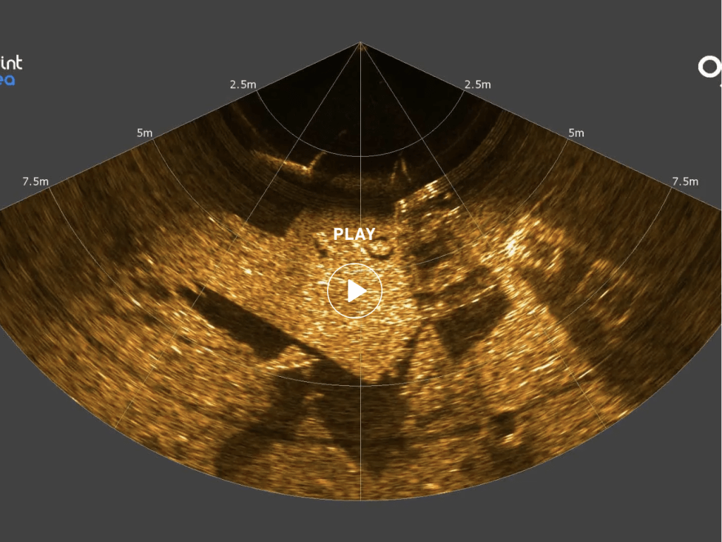
Build project-selected spatial records for exposed pipelines, manifolds, outfalls, tunnels and route features. Photogrammetry can be combined with sonar, LiDAR or survey control when one sensor cannot resolve the complete geometry.
Explore capability →Model intelligence
Build the geometry.
Preserve the evidence.
Reliable 3D Photogrammetry connects coverage, image quality, scale, control and validation from the first capture plan through the final model.
- 01 Design overlap and viewpoints around geometry
- 02 Control focus, exposure, lighting and scale
- 03 Identify occlusions and reacquire gaps
- 04 Verify measurements and document limitations
Capture platforms & processing
Underwater. Inside.
Above the asset.
3D Photogrammetry can connect ROV, UAS and confined-space imagery through a controlled workflow selected for the actual environment and final use.
 01
01SUBSEA / CONTACTLESS
ROV photogrammetry
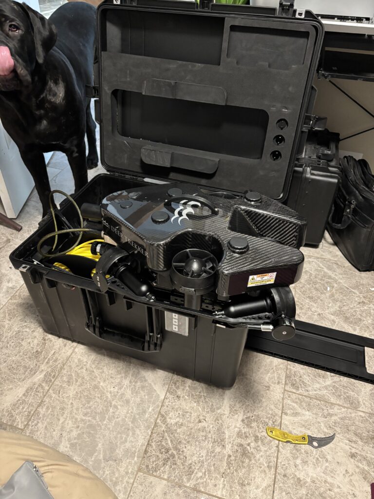
ROVs carry stabilized high-resolution cameras, structured lighting and project-selected scaling or positioning aids for repeatable image capture around submerged assets. Navigation, stand-off and coverage are planned around model completeness.
 02
02AERIAL / LARGE AREA
UAS photogrammetry
UAS platforms collect nadir and oblique imagery for terrain, structures, stockpiles, construction progress and topographic context. RTK, control and flight geometry are selected around the required output.
 03
03INTERIOR / COLLISION TOLERANT
Confined-space imaging
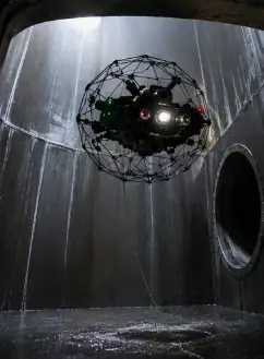
Collision-tolerant drones and robotic cameras can document suitable tanks, vessels, tunnels and restricted spaces without making human entry the first method. Low texture, dust, moisture and lighting are assessed before promising a model.
 04
04ALIGN / SCALE / VERIFY
Processing & model QA
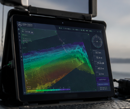
Image alignment, camera calibration, dense reconstruction, mesh generation, texturing, scaling and quality checks are completed against the project’s control and deliverable requirements.
Six-stage reconstruction workflow
Plan the capture.
Verify the model.
Ven-Tech keeps 3D Photogrammetry acquisition, control, processing and reporting connected so the model remains useful after the field team leaves.
Discuss your model scope ↗Start with the decision
Confirm the asset, required geometry, visible conditions, change or measurement objective, final formats, coordinate needs, model access and acceptance criteria.
Confirm photogrammetry suitability
Review visibility, turbidity, lighting, texture, reflectivity, motion, access, camera distance, occlusion, water distortion and whether sonar or LiDAR should supplement imagery.
Design scale and reference
Select calibrated scale bars, known dimensions, control points, RTK/GNSS, survey control, navigation references or other constraints appropriate to the model’s intended use.
Acquire deliberate overlap
Plan routes, camera angles, stand-off, lighting and overlap. Monitor focus, exposure, motion blur, colour, coverage and occlusions while additional imagery can still be collected.
Reconstruct and verify
Align imagery, optimize cameras, generate point cloud and mesh products, apply texture and scale, inspect residuals, compare check dimensions and document excluded or uncertain areas.
Package for the user
Issue the agreed model, point cloud, measurements, annotations, media, viewer and report with references, processing method, quality checks and limitations.
3D model deliverables
A digital record
built for use.
3D Photogrammetry deliverables are defined before mobilization so capture resolution, coverage, scale, control, model density and file formats support the intended engineering or asset workflow.
Textured 3D mesh
Photorealistic project-selected mesh for review, presentation and spatial inspection.
Dense point cloud
XYZ, LAS, LAZ or selected point formats with scale, reference and filtering information.
Digital twin viewer
Navigable model access for remote engineering, owner and maintenance collaboration.
Measurements
Agreed distances, areas, profiles, clearances or volumes with method and limitations stated.
Defect annotations
Referenced observations, screenshots, labels and links between the model and inspection record.
Change products
Selected comparisons, sections, heat maps or geometry review where repeat acquisitions support them.
CAD & GIS exports
Project-selected OBJ, FBX, DXF, XYZ, LAS, GeoTIFF or other compatible formats.
Technical report
Acquisition, control, processing, quality checks, coverage, findings, uncertainty and limitations.
About Ven-Tech Subsea
Technology in the field.
People behind the model.
The About Ven-Tech film introduces the survey, robotics, diving, reservoir and inspection teams behind complex data-acquisition work across Canada.
ABOUT VEN-TECH / 2025
One accountable project team
See the people, platforms and operating disciplines that connect inspection planning, controlled capture, model quality and client-ready reporting.
Learn more about Ven-Tech ↗Quality, scale & intended use
No model is accurate
by appearance alone.
Photorealism and measurement confidence are different things.
Overlapping imagery can reconstruct complex geometry, but scale and accuracy depend on camera calibration, viewing geometry, focus, control, surface texture, lighting, visibility and processing. Ven-Tech defines check dimensions or control appropriate to the intended use and documents unmodelled, occluded or uncertain areas.
Open formats also matter. The Open Geospatial Consortium’s 3D Tiles standard is designed for streaming large 3D geospatial content including photogrammetry and point clouds. Ven-Tech confirms the client’s viewer, CAD, GIS and archive requirements before processing rather than locking a project into one presentation format.
Image quality
Verify focus, exposure, lighting, colour, motion, stand-off and usable feature detail.
Coverage geometry
Control overlap, camera angles, route spacing, occlusion and return views around the asset.
Scale & control
Use suitable scale bars, known dimensions, control points, RTK or survey reference as required.
Model verification
Review alignment, residuals, check dimensions, mesh quality, gaps and intended-use limitations.
HSE · QUALITY · OPERATIONAL CONTROL
Remote access.
Accountable evidence.
Robotic capture can reduce exposure, but it still requires controlled launch and recovery, electrical and mechanical safety, traffic or airspace management, tether and access planning, communications, environmental limits, data control and emergency provisions.
BCCSA COR® CertifiedISNetworld Member ContractorISNetworld ESG BadgeAvetta ApprovedCognibox CertifiedAlcumus SafeContractorProject-specific capture plansScale and control verificationModel quality reviewTraceable data processingROV / UAS / sonar integrationATHENA™ operational framework
Where 3D models add value
Complex assets.
Shareable intelligence.
3D Photogrammetry supports owners and engineering teams responsible for difficult-to-access infrastructure, repeat inspections, construction verification and long-term asset records.
01Ports, piers & marine terminals↗
02Dams, reservoirs & tanks↗
03Pipelines, outfalls & manifolds↗
04Bridges, piles & foundations↗
05Marine construction & as-builts↗
06Industrial and confined spaces↗
07Environmental & habitat mapping↗
08UAS terrain & progress mapping↗
3D Photogrammetry FAQ
Plan the model
with confidence.
These answers are a practical starting point. Ven-Tech confirms suitability, capture method, control, HSE planning, model quality and deliverables for the actual site.
What is 3D Photogrammetry?+
3D Photogrammetry reconstructs geometry from multiple overlapping photographs taken from different positions. Structure-from-motion and related processing identify common image features, estimate camera geometry and generate project-selected point clouds, meshes, textures, measurements and visualization products.
Can 3D Photogrammetry work underwater?+
Yes, when visibility, lighting, image overlap, surface texture, stand-off and vehicle stability are suitable. Turbidity, reflective surfaces, repetitive textures, marine growth, moving objects and refraction can reduce quality. Ven-Tech reviews conditions and may combine optical capture with sonar or physical scale control.
How accurate is a photogrammetric model?+
Accuracy depends on the complete acquisition and control method: camera quality and calibration, focus, overlap, viewing geometry, scale, control points, stand-off, visibility, texture, processing and verification. Ven-Tech defines and checks the appropriate method for the intended use rather than claiming one universal accuracy.
What platforms can collect the imagery?+
Depending on the site, Ven-Tech can use ROVs, collision-tolerant confined-space drones, aerial UAS, tripods, handheld cameras or other controlled imaging systems. Platform selection follows access, environment, required coverage, scale, positioning, lighting and safety considerations.
Can the model be used for measurements and engineering?+
Suitable controlled models can support project-selected distance, area, profile, volume and spatial measurements. Whether a result is appropriate for engineering depends on the control, verification, uncertainty and acceptance criteria. The report states intended use and known limitations.
What if the water is too turbid for cameras?+
Photogrammetry is an optical method and requires usable imagery. If cameras cannot maintain focus, contrast and common features, Ven-Tech can evaluate multibeam imaging sonar, bathymetric mapping, LiDAR in suitable non-submerged conditions or direct inspection as complementary or alternate methods.
What 3D Photogrammetry deliverables are available?+
Deliverables can include textured meshes, dense point clouds, digital-twin viewers, model snapshots, measurements, profiles, annotated findings, change products, CAD or GIS exports, source imagery and a technical report describing acquisition, control, processing, quality and limitations.
What information is needed for a proposal?+
Provide the asset, location, dimensions, access, visibility or lighting, operating state, known hazards, required coverage, measurements, coordinate needs, desired formats, schedule and intended use. Existing drawings, photos, inspection records and known dimensions help Ven-Tech design the capture and control plan.
Start with the model’s purpose
Need a measurable
digital asset record?
Send the asset, dimensions, access, visibility or lighting, operating state, known hazards, required coverage, measurements, reference needs, schedule and final formats. Ven-Tech will help define a practical 3D Photogrammetry approach.