Place cameras and mapping sensors inside suitable assets before sending personnel into the interior.
ROBOTIC INSPECTION · LIDAR · SLAM · 3D
Confined space inspection & 3D mapping.
Remote first. Evidence always.
Ven-Tech delivers Confined Space Inspection Services across Canada using collision-tolerant drones, crawlers, ROVs, LiDAR, SLAM mapping and controlled visual inspection.
3DMapped interiors
HDIndexed imagery
QACoverage records
Reduce exposure. Improve context.
Take the sensor in.
Keep people out where possible.
Confined Space Inspection Services help owners collect visual and spatial evidence before committing personnel to difficult interiors.
Remote inspection is a control—not a universal exemption. The space, hazards, access, operating state and work scope still require assessment. Ven-Tech plans the robotic task around isolation, hazardous energy, atmosphere, contamination, communications, launch and recovery, and the client’s site program.
Collision-tolerant aerial systems can reach elevated and complex areas. Crawlers provide stable contact inspection along floors, walls, pipes and magnetic surfaces. ROVs address flooded or submerged zones. LiDAR, SLAM, video and photogrammetry can be combined when the geometry and environment support them.
The project begins with the decision: visual condition, coverage confirmation, dimensions, deformation, deposits, obstruction, baseline mapping or maintenance planning. Ven-Tech states what was observed, what remained inaccessible, how measurements were referenced and where another method or controlled entry is required.
Remote-first assessmentMulti-platform deploymentDocumented coverage & limits
Follow a planned route and monitor video, map growth and system health while the team can reacquire gaps.
Combine indexed observations with suitable spatial data so findings are easier to locate and communicate.
Separate confirmed evidence, blind spots and uncertainty before maintenance or controlled human entry.
Confined Space Inspection Services capabilities
Inspect the interior.
Build the spatial record.
Ven-Tech configures Confined Space Inspection Services around access, hazards, environment, minimum feature, mapping requirement and the client’s intended decision.
 01↗
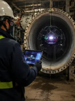
01↗Collision-tolerant aerial inspection
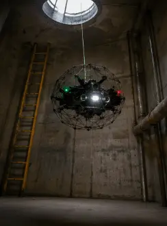
Deploy a protected indoor inspection drone through suitable access points to document roofs, walls, supports, piping, welds, coatings and internal equipment. Remote viewing can reduce routine personnel exposure while maintaining live operator control.
Explore capability →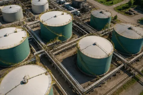 02↗
02↗LiDAR & SLAM mapping
Build project-selected point clouds and relative 3D geometry in GPS-denied interiors using LiDAR, inertial observations and simultaneous localization and mapping. Coverage, drift, loop closure and reference requirements are reviewed for the intended use.
Explore capability →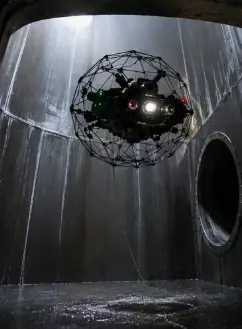 03↗
03↗Illuminated visual inspection
Capture stabilized high-definition video and still images with controlled lighting for corrosion, coating loss, cracks, deposits, deformation, loose components and other visible conditions. Findings remain tied to accessible coverage and image quality.
Explore capability →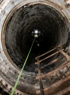 04↗
04↗Shaft, tunnel & vertical access
Inspect selected shafts, chambers, risers, tanks, silos and vertical structures without placing personnel throughout the interior. Tether, communications, retrieval, access protection and dropped-object controls are planned around the geometry.
Explore capability →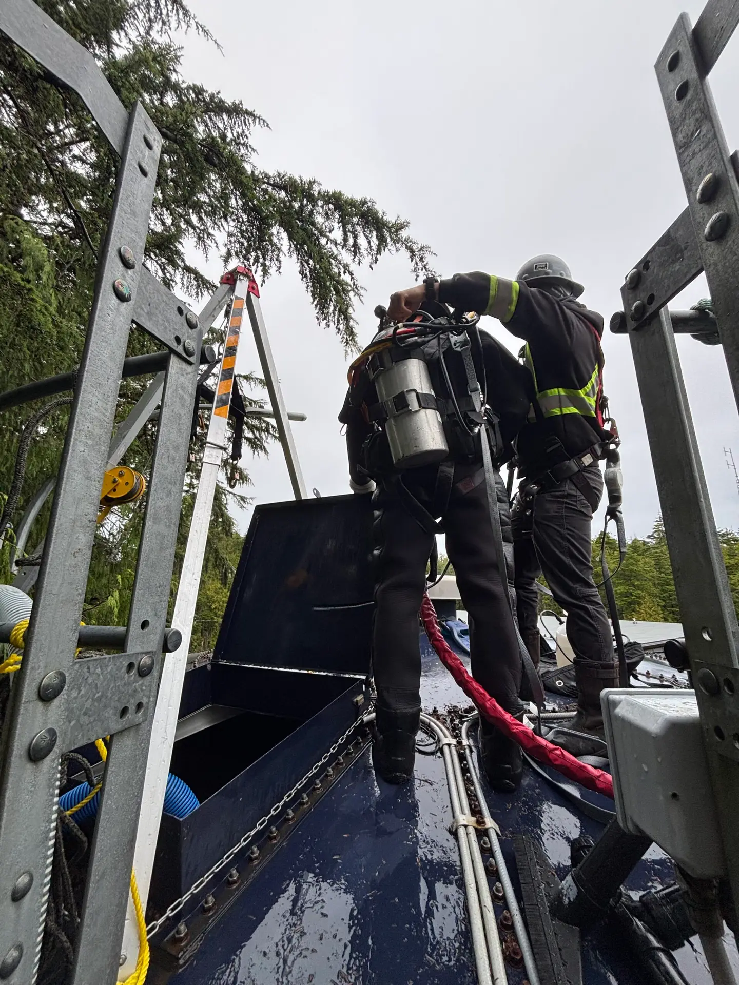 05↗
05↗Crawler & tethered robotics
Use tracked, magnetic, wheeled or tethered systems where flight is unsuitable or controlled surface contact improves stability. Platform selection follows material, traction, slope, debris, water, diameter and recovery requirements.
Explore capability →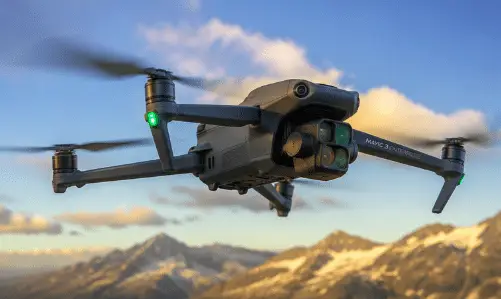 06↗
06↗3D condition & change records
Combine mapping, imagery, annotations and project references into a reviewable asset record. Repeatable control can support comparison, deformation screening and maintenance planning when the method and uncertainty are appropriate.
Explore capability →Hierarchy of controls
Remote first.
Entry only when required.
A robot can reduce exposure, establish preliminary condition and identify the exact locations that need cleaning, testing, repair or direct verification. It does not replace the owner’s confined-space program.
- 01 Identify the space and intended work
- 02 Eliminate or control hazardous energy
- 03 Inspect remotely where the method is suitable
- 04 Plan controlled entry for unresolved tasks
Robotic inspection platforms
Fly. Crawl. Swim.
Recover deliberately.
Confined Space Inspection Services can combine aerial, tethered, crawler and underwater platforms according to geometry, environment, traction, communications, payload and recovery needs.
 01
01FLIGHT / VISUAL / LIDAR
Collision-tolerant inspection drone
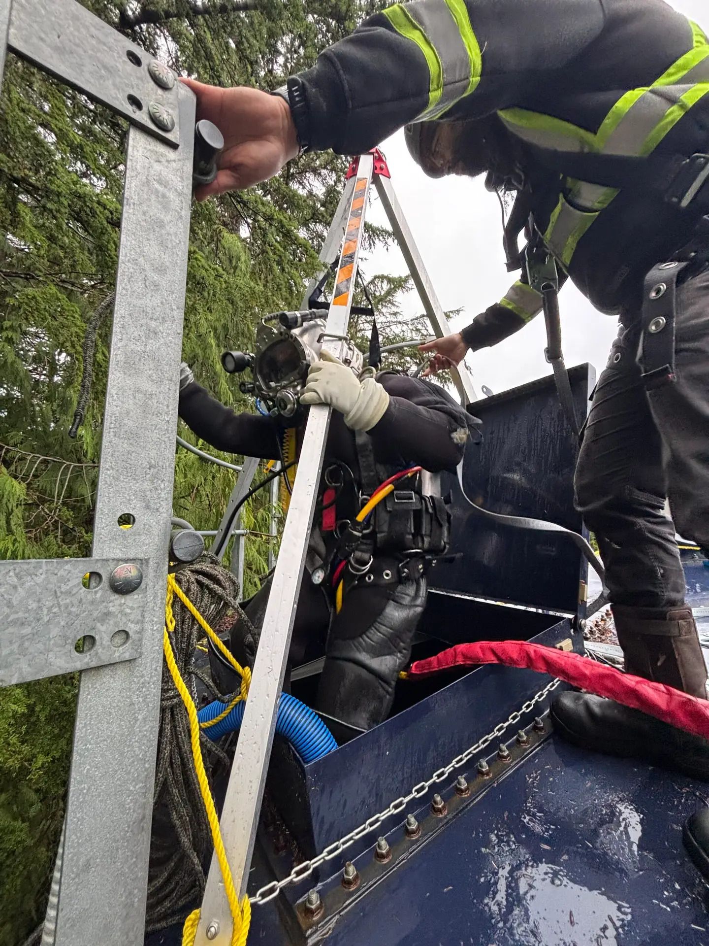
Protected aerial platforms support close visual inspection and project-selected mapping in dark, GPS-denied spaces. Access size, airflow, dust, moisture, temperature, radio conditions, obstacles, endurance and recovery route are confirmed first.
 02
02ENDURANCE / RECOVERY
Tethered & specialty aerial systems
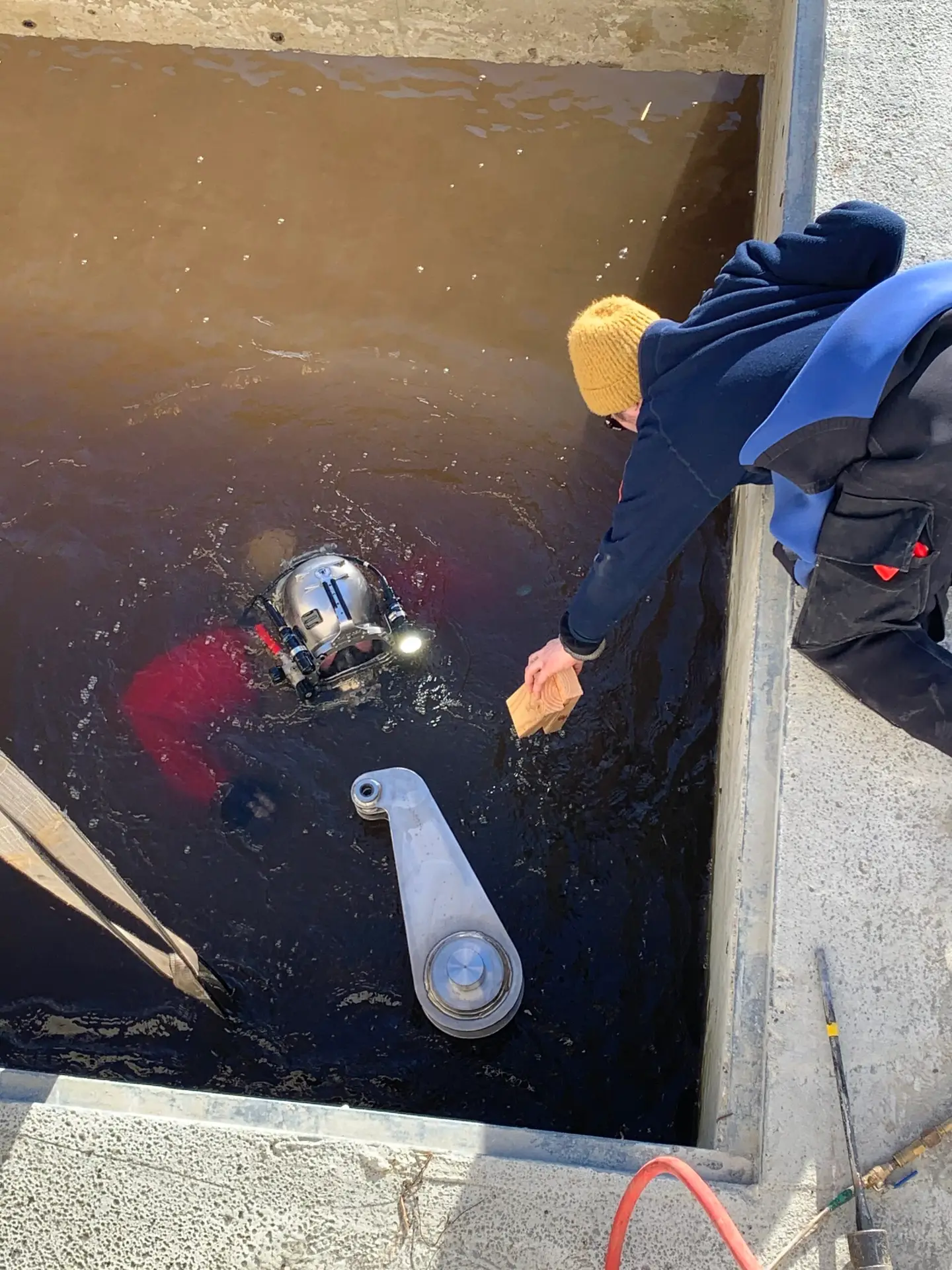
Tethered or mission-specific platforms can support extended observation, controlled retrieval or specialized environments where the asset and access permit. Cable management, snag risk and emergency recovery remain part of the plan.
 03
03SURFACE / WET / PIPE
Crawlers, ROVs & magnetic platforms
Crawlers and ROVs extend remote inspection into pipes, tanks, wet wells, partially flooded structures and surfaces where flight is impractical. Camera, sonar, lighting, measurement and recovery options follow the scope.
 04
04REGISTER / VERIFY / REPORT
Mapping & review workstation
Video, stills, LiDAR, SLAM trajectory, measurements, annotations and asset references are reviewed together. Processing creates project-selected point clouds, models, plans, sections, defect registers and reports.
Six-stage inspection workflow
Control access.
Control the evidence.
The Confined Space Inspection Services workflow connects hazard controls, platform selection, function testing, live coverage verification and final reporting.
Discuss your inspection scope ↗Specify the decision
Confirm the asset, operating state, access, known hazards, priority areas, minimum defect or feature, measurement need, required coverage, reference and final deliverables.
Address hazardous energy
Review isolation, lockout, flow, pressure, engulfment, mechanical movement, electrical sources, contamination, atmosphere, access security and client permit requirements before deployment.
Match platform to geometry
Choose aerial, crawler, ROV or combined systems around access opening, dimensions, surface, water, dust, airflow, lighting, communications, tether, endurance and recovery needs.
Verify outside the space
Complete function, camera, lighting, mapping, communications, battery, tether and retrieval checks. Confirm the launch area, exclusion controls, monitoring and stop-work criteria.
Control coverage live
Follow a planned route, monitor system health, review image and map quality, mark priority findings and reacquire gaps while the team and equipment remain mobilized.
Build the evidence record
Index media, register findings, process mapping data, state coverage and uncertainty, and issue the agreed point clouds, models, drawings, measurements and technical report.
Inspection & mapping deliverables
More than footage.
A usable asset record.
Confined Space Inspection Services deliverables are agreed before mobilization so route, lighting, mapping, reference, coverage and processing support the owner, engineer or maintenance team.
Indexed HD video
Route-based inspection video with filenames, timestamps, location context and priority observations organized for review.
Inspection stills
Selected high-resolution images with labels, orientation, finding references and project-selected measurements.
LiDAR point cloud
Project-selected point-cloud format with coordinate or local reference, coverage, registration and known limitations stated.
3D mesh or model
Reviewable surface, mesh or digital model derived from suitable mapping or photogrammetry data for the intended use.
Plans & sections
Selected floor plans, elevations, profiles, sections, dimensions, clearances and geometry extracted from controlled data.
Defect register
Referenced corrosion, coating loss, cracks, deformation, deposits, obstructions or anomalies with media and confidence.
Coverage & access map
Mapped route, observed areas, blind spots, inaccessible zones and locations requiring another method or controlled entry.
Technical report
Scope, equipment, access, controls, method, coverage, findings, measurements, data quality, limitations and recommended next actions.
About Ven-Tech Subsea
Technology inside.
Accountability outside.
The About Ven-Tech film introduces the robotics, UAS, diving, reservoir, pipe and survey teams supporting critical infrastructure work across Canada.
ABOUT VEN-TECH / 2025
One integrated field team
See the people and disciplines connecting remote access, HSE planning, platform readiness, inspection coverage, data quality and client-ready reporting.
Learn more about Ven-Tech ↗Confined-space management & evidence quality
Reduce entry.
Keep the controls.
Robotic deployment changes exposure—not the need for disciplined planning.
WorkSafeBC’s Part 9 guidance requires employers to identify confined spaces and determine whether worker entry is required. CCOHS guidance emphasizes a space-specific hazard assessment and control program, including roles, hazards, monitoring, procedures and emergency response when entry is involved.
Ven-Tech coordinates the remote inspection method with the applicable jurisdiction, owner program and worksite controls. The technical report separates confirmed observations, approximate or controlled measurements, inaccessible areas, data limitations and tasks requiring another method.
Coverage quality
Plan routes, orientations and overlap; record observed areas, blind spots, obstructions and reacquisition results.
Image quality
Control range, lighting, focus, motion, dust and surface visibility around the smallest required feature.
Mapping quality
Review SLAM trajectory, loop closure, registration, reference, drift, density, scale and intended use.
Finding traceability
Connect observations to media, map position, confidence, dimensions, coverage and recommended follow-up.
HSE · ISOLATION · ACCESS CONTROL · RECOVERY
Remote inspection.
Controlled worksite.
The launch team may remain outside the space, but the operation still addresses access protection, hazardous energy, pressure, flow, engulfment, contamination, atmosphere, ventilation interfaces, electrical and battery controls, communications, dropped objects, equipment retrieval, rescue implications, decontamination and client permits as applicable.
BCCSA COR® CertifiedISNetworld Member ContractorISNetworld ESG BadgeAvetta ApprovedCognibox CertifiedAlcumus SafeContractorCSA Z1006-aligned planningProvincial regulation reviewHazard assessment & controlsIsolation / lockout coordinationAtmospheric monitoring as requiredRecovery planningLive communicationsATHENA™ operational framework
Confined Space Inspection Services applications
Complex interiors.
Clearer decisions.
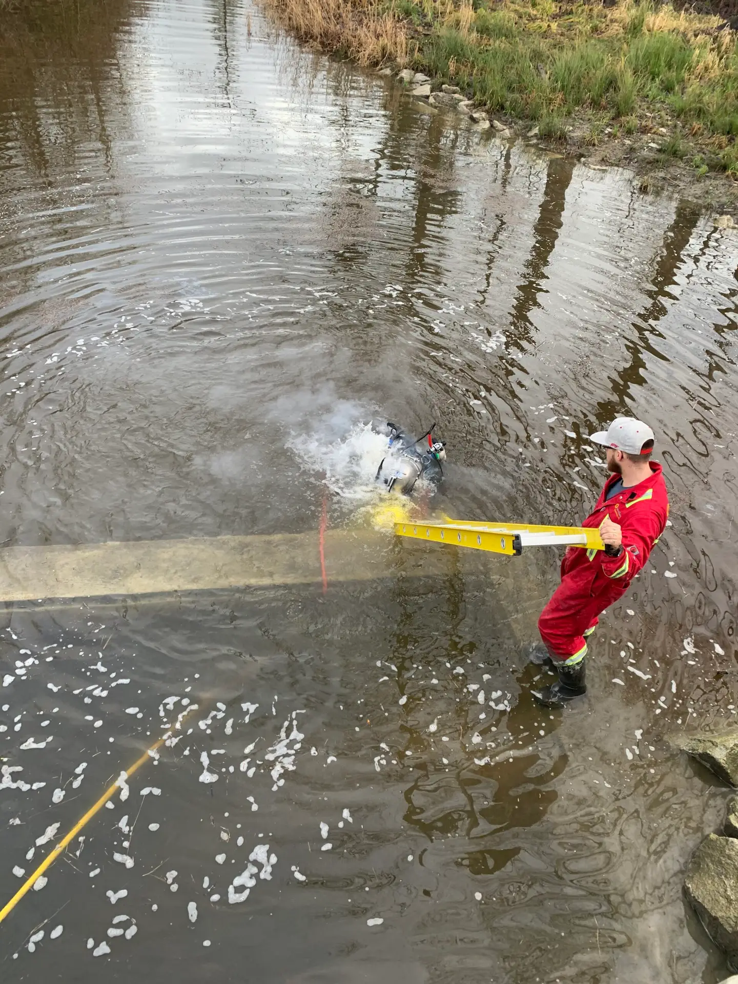
Confined Space Inspection Services support organizations responsible for enclosed water, process, civil, mining, marine and utility infrastructure.
01Water tanks & reservoirs↗
02Silos, bins & hoppers↗
03Industrial vessels & chambers↗
04Tunnels, shafts & galleries↗
05Sewers, culverts & storm systems↗
06Pipelines, penstocks & conduits↗
07Marine voids & ballast spaces↗
08Mining & process infrastructure↗
Confined Space Inspection Services FAQ
Plan the inspection
with confidence.
These answers are a practical starting point. Ven-Tech confirms access, hazards, controls, platform, sensor, recovery, coverage and deliverables for the actual asset.
What are Confined Space Inspection Services?+
Confined Space Inspection Services use project-suitable drones, crawlers, ROVs, cameras, LiDAR and mapping systems to collect visual and spatial evidence inside difficult enclosed assets. The method is selected around access, hazards, geometry, environment, coverage and the client’s required decision.
Can robotic inspection eliminate confined space entry?+
Remote inspection can eliminate or reduce some planned entries, but it does not automatically remove the legal classification, site controls or need for future entry. The employer and project team must still identify the space, assess hazards and determine the controls required for the actual work.
How accurate is confined space 3D mapping?+
Accuracy depends on the sensor, geometry, range, surface reflectivity, dust, moisture, motion, SLAM trajectory, loop closure, control, registration and processing. Ven-Tech defines whether the result is visualization, relative geometry, measured mapping or a controlled survey product before acquisition.
What assets can be inspected?+
Suitable assets may include tanks, reservoirs, silos, vessels, chambers, tunnels, shafts, culverts, sewers, pipelines, penstocks, process spaces, marine voids and mining infrastructure. Access, dimensions, atmosphere, contamination, operating state and recovery requirements determine feasibility.
Can the systems inspect wet or partially flooded spaces?+
Yes, when a project-suitable platform and controls are available. A collision-tolerant aerial drone may inspect above the waterline, while an ROV or crawler can address submerged or contact-based areas. The scope defines electrical, contamination, tether and recovery controls.
What defects can remote systems identify?+
High-quality imagery can document visible corrosion, coating loss, deposits, cracks, deformation, leakage evidence, loose components, obstructions and weld or support condition. Detection depends on access, lighting, range, surface cleanliness, image quality and the size and orientation of the feature.
What deliverables are available?+
Depending on scope, Confined Space Inspection Services can provide indexed video, inspection stills, defect registers, LiDAR point clouds, 3D meshes, plans, profiles, sections, measurements, coverage maps, CAD or BIM-ready exports and a technical report with limitations.
What information is needed for a proposal?+
Provide the asset type, location, operating state, access opening, internal dimensions, drawings, known hazards, isolation status, atmosphere or contamination concerns, priority areas, smallest required feature, mapping or measurement needs, schedule and deliverable formats.
Start with the asset and access
Need to inspect inside
without routine entry?
Send the asset type, operating state, access opening, internal dimensions, drawings, known hazards, isolation status, priority areas, minimum feature, mapping needs, schedule and desired deliverables. Ven-Tech will help define a practical Confined Space Inspection Services approach.