Use acoustic energy to visualize suitable structures and targets through darkness, suspended sediment and turbid water.
ACOUSTIC INSPECTION · BATHYMETRY · 3D DATA
Multibeam imaging
sonar services.
Clarity without visibility.
Ven-Tech provides Multibeam Imaging Sonar Services across Canada for underwater inspection, zero-visibility imaging, bathymetric mapping, search, scour, dredging and marine-construction verification.
2DLive acoustic imaging
3DMapped surfaces
CACanada-wide support
See through darkness and turbidity
When cameras stop.
The inspection continues.
Professional Multibeam Imaging Sonar Services convert acoustic returns into useful evidence—not just colourful sonar screenshots.
Ven-Tech starts with the decision the client needs to make. Structural inspection, target detection, close-range navigation, bathymetric mapping and dredging verification require different sonar frequencies, mounting, platforms, positioning, acquisition patterns and deliverables.
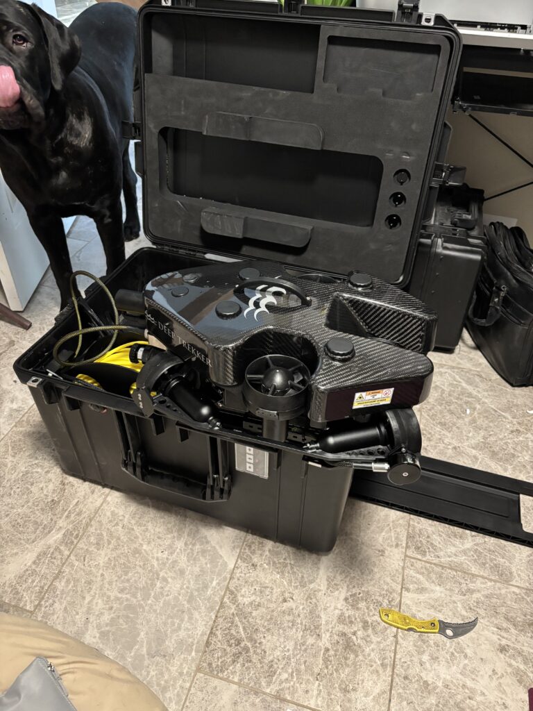
Compact imaging sonar can provide live stand-off awareness and target imagery from an ROV or crawler in low visibility. Survey-grade multibeam systems carried by a USV or vessel can produce dense, georeferenced depth data for surfaces, contours, profiles, change maps and volumes. Some projects combine both methods with optical video, positioning, LiDAR, photogrammetry or direct inspection.
Every result is tied to the operating geometry, field settings, data quality, processing assumptions and limitations. That context lets engineers, owners and project teams distinguish a useful observation from an unsupported conclusion.
Mission-selected sonarLive field quality controlDecision-ready deliverables
Maintain stand-off, orientation and target awareness while the vehicle or vessel works around complex underwater assets.
Acquire broad swaths or deliberate close-range views according to the required inspection or survey outcome.
Turn field acquisition into referenced imagery, targets, surfaces, measurements and traceable technical reporting.
Multibeam Imaging Sonar Services capabilities
From live imagery
to mapped surfaces.
For Multibeam Imaging Sonar Services, the right method depends on whether the project needs target visibility, structural context, positioned depths, measured change or a combined inspection record.
 01↗
01↗Infrastructure inspection
High-frequency acoustic imagery supports condition screening around dams, bridge piers, wharves, walls, foundations, gates, intakes, outfalls, pipelines and other submerged structures where optical visibility is limited.
Explore the method →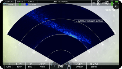 02↗
02↗Low- and zero-visibility imaging
Real-time sonar gives the ROV pilot and inspection team positional context, stand-off awareness and target imagery when turbidity, darkness, suspended sediment or confined geometry makes cameras ineffective.
Explore the method →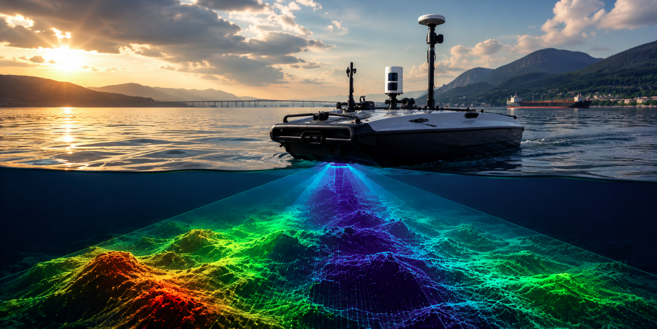 03↗
03↗Bathymetry & 3D surfaces
Survey-grade multibeam systems mounted on suitable vessels or USVs collect dense, positioned depth data for reservoirs, rivers, harbours, channels, nearshore areas and engineering survey programs.
Explore the method →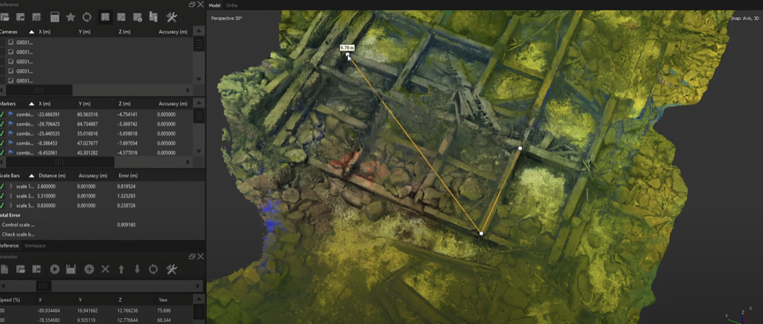 04↗
04↗Dredging & volume verification
Pre-work, progress and post-work datasets support dredge planning, quantities, clearance review, sediment distribution, reservoir-capacity assessment and surface-to-surface change analysis.
Explore the method →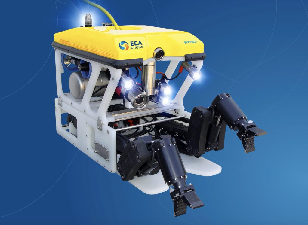 05↗
05↗Search & target investigation
Sonar-led search patterns locate and reacquire suitable objects, debris, obstructions and submerged hazards before close-range ROV verification or recovery planning.
Explore the method →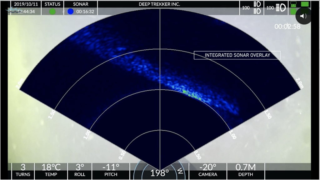 06↗
06↗Construction QA & change detection
Baseline, placement and as-built acoustic data can document excavation, structure position, scour protection, underwater concrete, dredging and other marine-construction changes.
Explore the method →Signal to decision
Capture the return.
Preserve the context.
A strong sonar program connects sensor selection, platform control, image or sounding quality, spatial reference and reporting from the first mission plan through the final record.
- 01 Select frequency, range and field of view
- 02 Control mounting, motion and platform geometry
- 03 Verify coverage and data quality in the field
- 04 Process, reference and document limitations
Advanced sonar fleet
Close-range detail.
Survey-scale coverage.
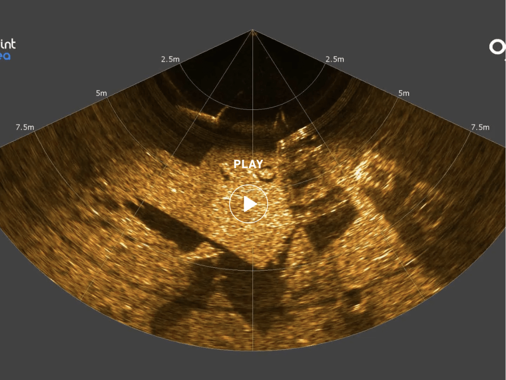
Ven-Tech configures Multibeam Imaging Sonar Services around the target, environment, deployment platform and required output—not around one fixed sonar model.
 01
01COMPACT / DUAL FREQUENCY
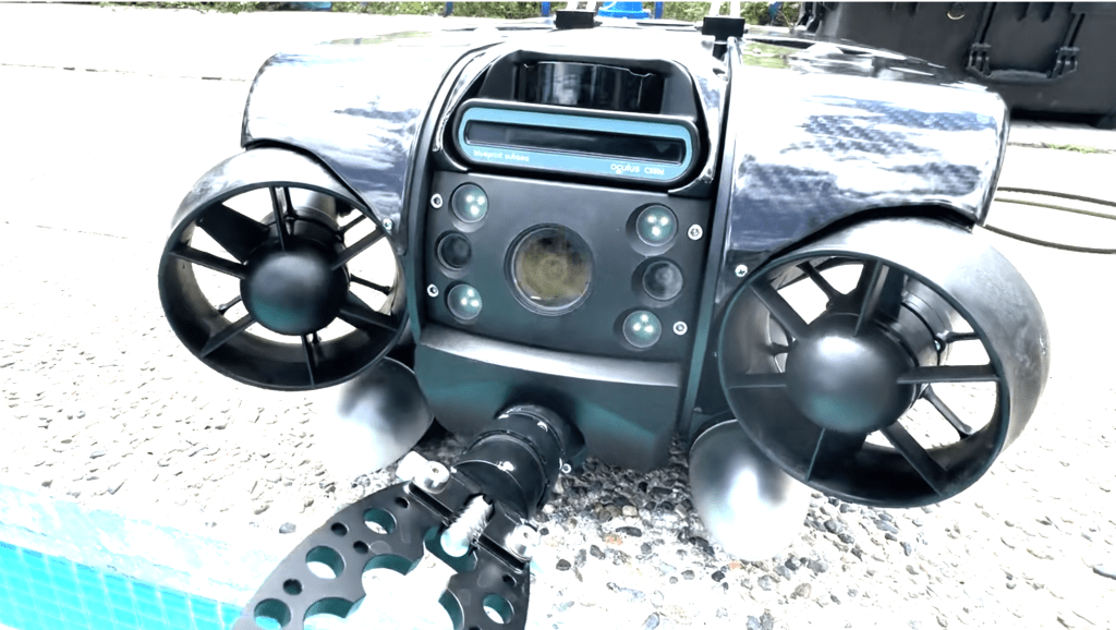
Oculus C550D
A compact dual-frequency imaging sonar for real-time navigation, target detection and structure inspection from suitable ROVs and robotic platforms. Selection follows range, stand-off, field of view and required detail.
 02
02SHORT RANGE / HIGH DETAIL
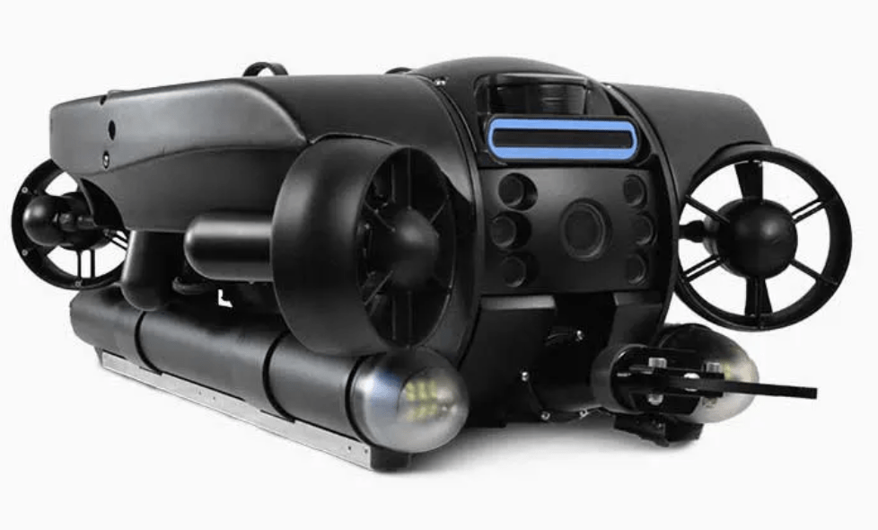
Oculus M3000D
A high-frequency imaging sonar configured for detailed close-range work in confined or turbid water. It is useful when the inspection depends on fine acoustic definition rather than long-range search coverage.
 03
03RANGE / RESOLUTION BALANCE
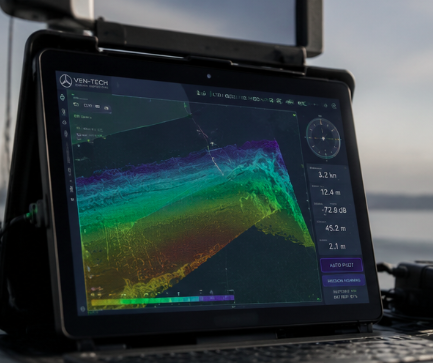
Oculus M1200D
A versatile imaging sonar for navigation, target investigation and structural inspection where the mission needs a practical balance between acoustic range, image update and close-range definition.
 04
04SURVEY / GEOREFERENCED
NORBIT multibeam systems
Survey-grade multibeam systems integrate positioning, heading, motion and sound-velocity control to produce dense bathymetric datasets, point clouds, surfaces and engineering-ready survey products.
Six-stage sonar workflow
Design the method.
Verify the evidence.
Multibeam Imaging Sonar Services are most useful when planning, equipment, field quality and processing remain connected. Ven-Tech uses a defined workflow so the final record matches the intended decision.
Discuss your sonar scope ↗Start with the decision
Confirm the asset, inspection question, survey purpose, required coverage, target dimensions, accuracy specification, reference system, schedule and final file formats.
Understand the environment
Review access, depth, current, turbidity, geometry, obstructions, vessel traffic, tether route, launch and recovery, control, sound conditions and known hazards.
Select the sonar and platform
Match frequency, range, field of view, mounting, ROV, USV, crawler or vessel, positioning, motion compensation, line plan and calibration to the required evidence.
Prepare the work package
Document roles, equipment checks, HSE interfaces, operating limits, communications, exclusion zones, data-quality checks, recovery provisions and stop-work criteria.
Verify coverage live
Monitor sonar health, range, gain, image quality, navigation, overlap, motion, positioning and target coverage; repeat questionable lines or views before demobilization.
Process with context
Apply agreed corrections and quality checks, retain limitations, organize target and observation references, and issue the required imagery, models, surfaces and report.
Sonar project deliverables
More than an image.
A usable project record.
Multibeam Imaging Sonar Services deliverables are established before mobilization so acquisition, positioning, resolution and processing support the intended engineering, operational or compliance use.
Sonar video & snapshots
Recorded acoustic imagery and selected stills showing target approach, inspection coverage, notable conditions and operator observations.
Target register
Coordinates or referenced locations, dimensions, confidence, screenshots, descriptions and recommended follow-up for identified targets.
Bathymetric surface
A cleaned, gridded depth model with colour ramp, shaded relief and appropriate resolution for the acquisition density and intended use.
Point cloud
Processed XYZ or project-selected point data with stated reference system, filtering, coverage and limitations.
Contours & profiles
Engineering figures, cross-sections, longitudinal profiles, clearances and selected measurements tied to the agreed survey reference.
Volumes & change maps
Surface-to-surface comparisons for dredging, sediment, scour, reservoir capacity or construction progress with assumptions documented.
GIS/CAD-ready files
Agreed raster, vector, surface and point formats prepared for the client’s design, mapping or asset-management workflow.
Technical report
Scope, equipment, control, methods, calibration, quality checks, results, limitations, deliverable index and practical recommendations.
About Ven-Tech Subsea
Technology in the field.
People behind the result.
The About Ven-Tech film introduces the company, field disciplines and operating approach supporting sonar, ROV, USV, survey and complex infrastructure projects.
ABOUT VEN-TECH / 2025
One integrated field team
See the people, equipment and operating environments behind Ven-Tech’s inspection, robotics, survey, reservoir and commercial-diving capability across Canada.
Learn more about Ven-Tech ↗Accuracy, standards & acceptance
Specify the result.
Then design the survey.
No sonar model creates survey accuracy by itself.
Positioning, control, heading, motion, sound velocity, mounting, latency, calibration, line plan, environmental conditions, processing and acceptance checks all contribute to the final result. For hydrographic Multibeam Imaging Sonar Services, Ven-Tech reviews the current project specification and the applicable order or requirements from IHO S-44 Edition 6.2.0. Structural imaging, navigation and search projects may use different acceptance criteria.
Ven-Tech documents the selected equipment, acquisition method, references, quality checks and known limitations so the client can understand how the data should—and should not—be used.
Reference systems
Define horizontal and vertical datums, control, water level, geoid or chart datum and required transformations before acquisition.
Calibration & checks
Address mounting offsets, patch tests or project-selected checks, sound velocity, latency, sensor health and repeatability.
Field quality control
Monitor coverage, overlap, density, range, motion, navigation, image quality and anomalous results while remobilization is still possible.
Processing traceability
Retain corrections, filtering, assumptions, exclusions and limitations through the final surface, image, model and report.
HSE · QUALITY · OPERATIONAL CONTROL
Remote sensors.
Accountable execution.
ROV, USV and vessel-based Multibeam Imaging Sonar Services still require controlled launch and recovery, electrical and mechanical safety, tether or traffic management, environmental limits, communications, exclusion areas, emergency arrangements and competent supervision.
BCCSA COR® CertifiedISNetworld Member ContractorISNetworld ESG BadgeAvetta ApprovedCognibox CertifiedAlcumus SafeContractorProject-specific HSE plansLive field quality controlTraceable data processingIHO S-44 project alignmentROV / USV / vessel integrationATHENA™ operational framework
Industries we support
Hidden assets.
Visible decisions.
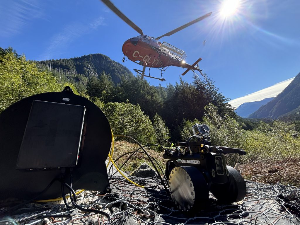
Multibeam Imaging Sonar Services support owners and engineering teams responsible for underwater infrastructure, safe navigation, construction quality, environmental performance and asset continuity.
01Hydropower, dams & reservoirs↗
02Ports, harbours & marine terminals↗
03Bridges & transportation infrastructure↗
04Oil, gas, pipelines & offshore energy↗
05Municipal water & wastewater↗
06Dredging & marine construction↗
07Mining, tailings & industrial facilities↗
08Environmental, fisheries & habitat programs↗
Multibeam Imaging Sonar Services FAQ
Plan the mission
with confidence.
These answers provide a practical starting point. Ven-Tech confirms the sonar, platform, acquisition method, HSE controls and deliverables for the actual site.
What are Multibeam Imaging Sonar Services used for?+
Multibeam Imaging Sonar Services support underwater structure inspection, low-visibility navigation, target detection, search and recovery, bathymetric mapping, scour and sediment assessment, dredging verification, construction QA and change analysis. The sonar, platform and deliverable are selected around the actual engineering or operational question.
Can multibeam sonar work in zero visibility?+
Yes. Acoustic systems do not depend on water clarity in the same way as optical cameras, so they can provide useful imagery and navigation context in darkness or turbid water. Resolution still depends on frequency, range, angle, target material, motion, mounting and operating technique, and limitations are documented.
What is the difference between imaging sonar and survey multibeam?+
Imaging sonar is commonly used for real-time target visualization, navigation and close structural inspection. Survey-grade multibeam echosounders collect positioned depth measurements across a swath to build bathymetric surfaces and point clouds. Some projects use both because inspection imagery and georeferenced survey data answer different questions.
Which platform carries the sonar?+
Ven-Tech can integrate project-selected sonar on suitable ROVs, USVs, robotic crawlers, crewed vessels or fixed deployment arrangements. Access, depth, current, range, motion, mounting geometry, positioning, payload, power and the required data determine the practical platform.
Can sonar measure scour, sediment or underwater geometry?+
Survey-grade multibeam can produce dense depth observations used for surfaces, profiles, contours, scour assessment, sediment distribution and volume calculations. Close-range imaging sonar may also support referenced dimensions. Measurement uncertainty and suitability depend on the complete acquisition and processing method—not the sonar model alone.
Do all sonar projects follow IHO S-44?+
No. IHO S-44 is principally a standard for hydrographic surveys, and the applicable order, uncertainty requirements and deliverables must be specified for the intended use. Structural imaging, navigation support or search work may use different acceptance criteria. Ven-Tech confirms the relevant standard and client specification before acquisition.
What deliverables are available after a sonar project?+
Depending on scope, Multibeam Imaging Sonar Services can provide recorded sonar, snapshots, target registers, positioned observations, cleaned soundings, point clouds, bathymetric surfaces, contours, profiles, change maps, volumes, GIS or CAD exports and a technical report with methods, quality checks and limitations.
What information is needed for a sonar proposal?+
Provide the site and asset, project purpose, approximate area or dimensions, depth, access, current and visibility, available drawings or control, known hazards, target size, required measurements or accuracy, reference system, desired outputs and schedule. Previous survey or inspection data is especially useful for change analysis.
Start with the underwater question
Need clarity
where cameras cannot see?
Send the site, asset, water depth, access, conditions, target size, inspection or survey objective, required measurements, reference system, schedule and final deliverables. Ven-Tech will help define a practical Multibeam Imaging Sonar Services approach.