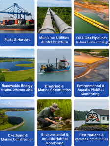
Ven-Tech Subsea delivers industry-leading Hydrographic Survey Services to support marine construction, port development, infrastructure inspections, and environmental compliance. Using cutting-edge single and multibeam echo sounders, tide gauges, and GNSS positioning systems, we generate precise bathymetric data for planning, dredging, engineering, and permitting.
Whether in deep ocean, river, port, reservoir, or tailings pond—our team delivers accurate, real-time seafloor mapping and water column insights.
Hydrographic surveying involves measuring and mapping the physical features of water bodies and submerged terrain. It is essential for:
Water depth (bathymetry)
Navigational charting
Seabed morphology and sediment monitoring
Dredge planning and volume calculations
Infrastructure assessments (dams, piers, intakes)
Environmental baseline mapping
We combine precise sonar systems with motion sensors and real-time GNSS corrections to produce detailed digital terrain models and hydrographic maps.
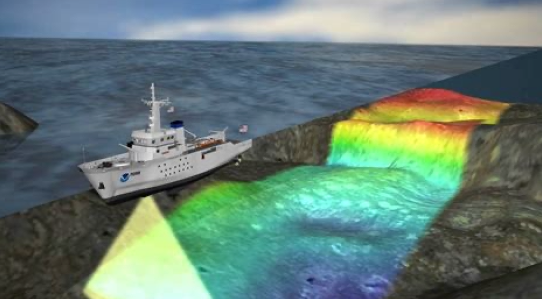
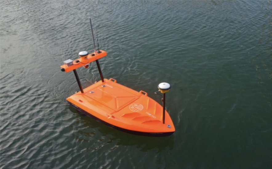
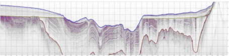
Hydrographic surveys using multibeam and single-beam echosounders mounted on USVs, ROVs, or survey vessels to capture precise underwater terrain data. Our systems generate dense bathymetric point clouds and digital elevation models (DEMs) for navigation charts, dredging pre-surveys, and reservoir capacity analysis. RTK GNSS and inertial navigation ensure centimeter-level accuracy.
Acoustic Doppler Current Profilers (ADCPs) and CTD sensors are deployed to measure water depth, temperature, salinity, turbidity, and flow velocity throughout the water column. These measurements inform sediment transport studies, intake and outfall design, and environmental assessments for inland and coastal waters.
Using UAV LiDAR, RTK GNSS, and multibeam sonar, we create seamless topobathymetric models that combine terrestrial and underwater terrain data. This integrated approach supports flood modeling, harbor development, and shoreline stabilization projects by mapping the full interface between land and water.
All hydrographic data is processed to IHO (International Hydrographic Organization) standards and formatted for CAD, GIS, and navigation systems. Deliverables include ENC-ready charts, cross-sections, surface models, and compliance documentation for port authorities, municipalities, and regulatory submissions.
Multibeam Echo Sounders (MBES)
Single Beam Echo Sounders (SBES)
Tidal Gauges & TideMaster Systems
Sound Velocity Profilers (SVP)
RTK & GNSS Positioning Systems
Hydrographic systems are deployed from:
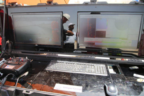
All platforms include real-time logging, GPS integration, and mobile command centers for efficient operations.
We produce high-quality, engineer-ready outputs tailored to your project:
-Digital Elevation Models (DEMs)
-Contour maps & bathymetric charts
-Volume & cut-fill calculations for dredging
-Longitudinal and cross-sectional profiles
-CAD-compatible files (.DXF, .DWG)
-GIS datasets (.SHP, .XYZ, .LAS)
-QA/QC-certified survey reports


Multidisciplinary Robotic Fleet
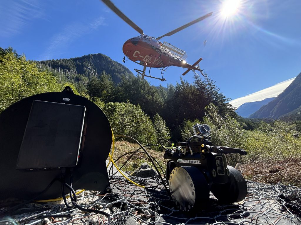
Ven-Tech Subsea delivers exceptional hydrographic survey capabilities through our advanced fleet of unmanned surface vessels (USVs), autonomous underwater vehicles (AUVs), and robotic sensor platforms. Our systems are engineered for adaptability—capable of performing precision surveys in ports, reservoirs, tailings ponds, and challenging environments such as shallow or remote inland waters. Whether mapping bathymetric contours or assessing submerged structures, our technologies are purpose-built for high-resolution, low-impact data acquisition.
Safety-Driven Operations
We prioritize safety above all else. Our hydrographic survey approach significantly reduces the need for confined space entry, diver deployment, or manual sediment sampling. By leveraging remote and robotic systems, we eliminate high-risk operations and ensure compliance with all provincial safety mandates. Our work is conducted in full alignment with CSA Standard Z1006 (Confined Spaces) and WorkSafeBC’s Confined Space Entry Program, ensuring the safety of personnel and the environment at all times.
Regulatory & Technical Excellence
We operate under the strictest standards of industry compliance. From certified hydrographic methods and QA/QC procedures to data formats required by permitting authorities, our services are fully audit-ready. Ven-Tech Subsea is proudly certified by ISNetworld, BCCSA COR, Avetta, and Cognibox, and maintains full insurance coverage, including $5M Commercial General Liability and $2M Professional Errors & Omissions.
Integrated, High-Value Data Reporting
Our hydrographic packages are not just surveys—they are decision-making tools. Utilizing multibeam sonar, RTK-GPS, side scan sonar, and photogrammetry, we produce high-accuracy deliverables such as bathymetric DEMs, volume reports, sediment models, and CAD/GIS-compatible formats (DXF, SHP, LAS, PDF). Final reports are formatted to satisfy regulatory submission standards and engineering requirements, allowing for seamless integration into your workflows.
Powered by ATHENA™
All hydrographic survey missions are coordinated through our proprietary ATHENA™ platform—an AI-enhanced analytics and compliance management system. ATHENA™ ensures that every detail, from operational logs to QA/QC validations, is recorded, timestamped, and archived. This not only provides full transparency but also futureproofs your project for audits, legal reviews, or stakeholder presentations.
Ready to move your hydrographic survey project forward with industry-leading precision and professionalism?
At Ven-Tech Subsea, we specialize in delivering high-resolution hydrographic data that supports regulatory compliance, engineering design, dredging, environmental permitting, and infrastructure planning. Whether you’re a port authority, municipality, energy developer, or environmental consultant, our multidisciplinary team is ready to assist.