 01↗
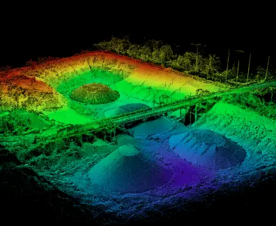
01↗Topographic LiDAR surveys
Capture detailed elevation data across complex terrain for engineering design, drainage, planning, grading and existing-condition documentation.

UAS LiDAR Services
UAS LiDAR Services for high-density point clouds, bare-earth terrain, corridors, forestry, mining and engineering projects across British Columbia and Canada.
Beyond the visible surface
Engineering teams need more than attractive imagery. They need spatial data that describes the terrain, structures and change across the complete project area.
Ven-Tech plans each airborne LiDAR mission around the required accuracy, terrain, vegetation, control, coordinate system and final engineering use. Our UAS LiDAR Services connect safe field acquisition, positioning, point-cloud processing and documented quality control in one disciplined workflow.
For projects requiring orthomosaics, imagery or broader surface products, LiDAR can be combined with our UAS surveying and mapping and advanced UAS services.
UAS LiDAR capabilities
Every mission is designed around the project decision and deliverable—not simply the number of points collected.
01↗Capture detailed elevation data across complex terrain for engineering design, drainage, planning, grading and existing-condition documentation.
 02↗
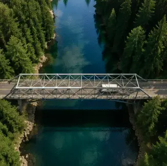
02↗Map roads, rail, pipelines, powerlines, shorelines and utility corridors with consistent coverage and engineering-ready spatial context.
 03↗
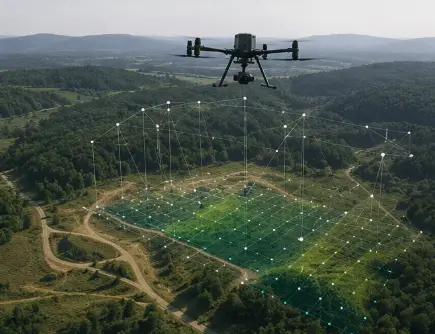
03↗Support canopy-height, vegetation-structure, terrain and access analysis where conventional image-only mapping may not reveal the full ground surface.
 04↗
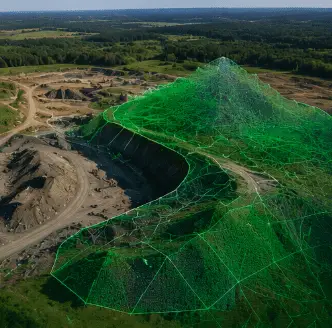
04↗Create measurable site records for pits, stockpiles, benches, haul roads, cut-and-fill analysis, material reconciliation and progress tracking.
 05↗
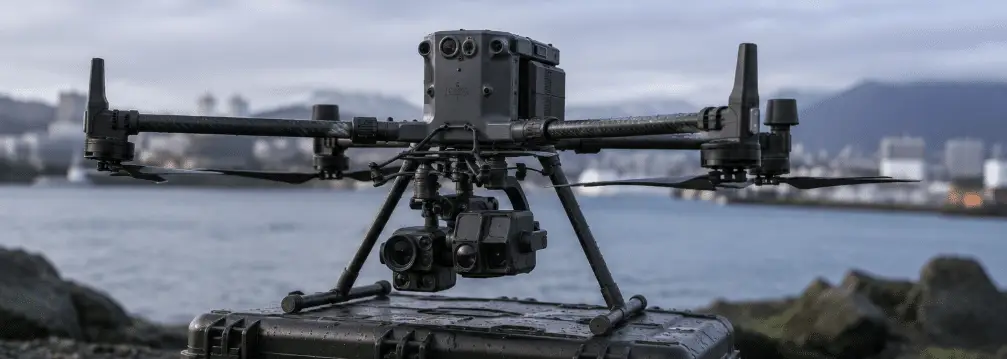
05↗Capture dense spatial detail around structures, facilities, earthworks and access-constrained assets for modelling, measurement and digital records.
 06↗
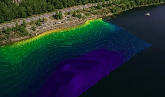
06↗Document terrain, banks, channels, erosion zones, habitat features and changing landscapes for environmental assessment and monitoring programs.
LiDAR intelligence
LiDAR acquisition combines laser ranging, GNSS and inertial measurement to create a three-dimensional record of the surveyed environment. The value comes from the complete workflow: trajectory, calibration, control, classification, verification and delivery.
Why UAS LiDAR
For suitable sites, UAS LiDAR Services can improve terrain capture, repeatability and three-dimensional understanding across challenging environments.
Collect multiple returns through canopy gaps to support ground modelling in suitable vegetation conditions.
Record dense three-dimensional detail across slopes, corridors, earthworks, structures and irregular surfaces.
Capture broad or difficult terrain with a structured aerial route and reduced ground-access requirements.
Use defined control, coordinate and acquisition methods to compare suitable sites and changes over time.
Accuracy & data quality
The acquisition, control and processing plan must match the terrain, required output and accuracy target. Ven-Tech confirms those requirements before mobilization and documents the selected workflow.
The GNSS workflow is selected around the site, required accuracy, control network, airspace and final engineering use.
Project control and independent checkpoints can be integrated where required to strengthen alignment and verify finished outputs.
Aircraft, LiDAR sensor, inertial data and positioning inputs are managed as one acquisition system rather than disconnected components.
Returns can be classified and organized for ground, vegetation, structures and other project-specific features where the data supports it.
Deliverables are prepared around the specified projection, datum, geoid, units and project coordinate framework.
Coverage, trajectory quality, control, noise, classification and check results are reviewed before the project data is issued.
LiDAR workflow
A disciplined process connects field acquisition to verified, usable spatial products.
Confirm the area, terrain, accuracy, coordinate system, classifications and required file formats.
Design the GNSS, ground control, checkpoints, altitude, speed, scan geometry and site controls.
Collect LiDAR and positioning data, then confirm coverage and field quality before demobilizing.
Calibrate, georeference, classify, check and organize the data for the intended project workflow.
Operational assurance
Ven-Tech’s UAS LiDAR Services are supported by the same contractor management, documentation and health-and-safety framework used across our industrial, municipal, marine and infrastructure operations.
Sectors we map
Designed for engineering firms, survey companies, asset owners and project teams that need dependable three-dimensional site information.
Common questions
Send us the site, terrain conditions, required accuracy and final deliverable. We’ll help define an appropriate acquisition and control strategy.
UAS LiDAR Services are used to collect dense three-dimensional elevation and surface data for topographic mapping, corridor surveys, forestry, mining, volumetrics, environmental monitoring, infrastructure documentation and engineering design support. The correct method depends on the terrain, vegetation, accuracy requirement and final deliverable.
LiDAR directly measures ranges using laser pulses and can record multiple returns from vegetation and complex surfaces. Photogrammetry builds geometry from overlapping photographs and also provides strong visual texture. Many projects benefit from one method, while others combine LiDAR with imagery. Ven-Tech selects the workflow around the project question rather than applying one sensor to every site.
LiDAR can record returns through gaps in vegetation and may provide substantially more ground information than image-only methods in suitable conditions. Results still depend on canopy density, understory, leaf conditions, flight geometry, sensor performance and classification quality. It should not be described as seeing through every canopy without limitation.
Accuracy depends on the sensor, aircraft, GNSS and inertial workflow, altitude, terrain, vegetation, control, calibration and processing. Ven-Tech confirms the project accuracy target and verification method during scoping instead of applying one blanket specification to every mission.
Depending on the scope, deliverables may include LAS or LAZ point clouds, classified ground and non-ground returns, digital surface models, digital terrain models, contours, hillshades, intensity products, GeoTIFF rasters, CAD or GIS-ready files, volume reports and project-specific 3D visualizations.
No. UAS LiDAR supports engineering, environmental and surveying workflows, but legal boundary and cadastral services must be completed or certified by the appropriately licensed land-surveying professional for the jurisdiction.
Start with the terrain
Tell us the project area, terrain, vegetation, required accuracy, coordinate system and intended output. Ven-Tech will provide a practical first assessment for your UAS LiDAR Services project.