Marine Surveying Services
Ven-Tech Subsea is proud to offer world-class Marine Surveying Services across Canada, delivering advanced inspection, mapping, and data acquisition capabilities to support a wide range of marine, coastal, and inland waterway projects. From our bases in British Columbia and Alberta, our team of experienced marine surveyors, hydrographers, ROV/USV pilots, and geospatial technicians work closely with clients in oil & gas, construction, engineering, government, utilities, and environmental sectors.
Our Marine Surveying Services combine cutting-edge technology with deep expertise in underwater and surface mapping, providing precise, actionable data that drives informed decisions in marine development, infrastructure maintenance, and environmental monitoring.
Core Capabilities
- Hydrographic Surveys: Using single-beam, multi-beam, and side-scan sonar, we map bathymetry, seabed composition, and sub-bottom profiles with high resolution.
- Geophysical and Geotechnical Surveys: We provide sub-bottom profiling, magnetometer readings, and soil sampling to assess sediment layers, bedrock profiles, and buried obstructions.
- ROV Surveys: Deployed for high-accuracy visual and sonar inspections of underwater assets such as pipelines, reservoirs, intakes, outfalls, and subsea cables.
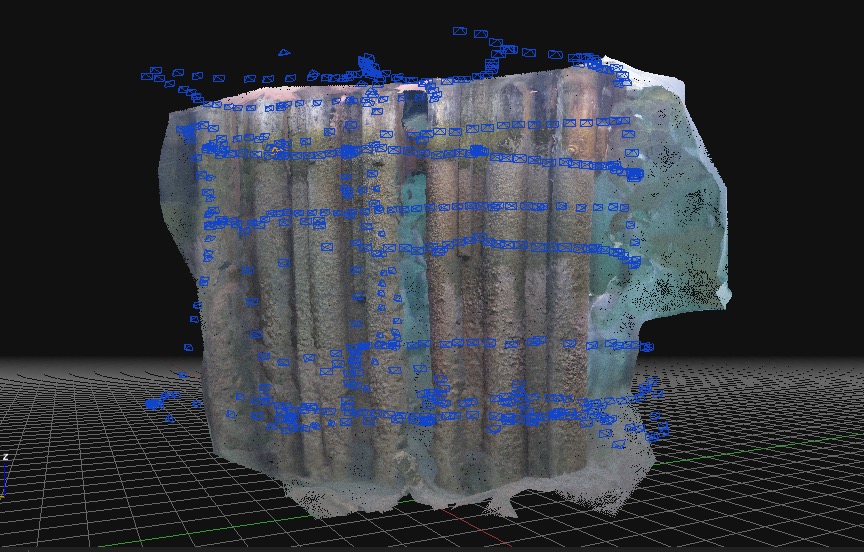
- USV Surveys (Unmanned Surface Vehicle): We deploy state-of-the-art USVs equipped with GNSS, RTK, and multibeam sonar for autonomous surveying in challenging or remote environments.
- Environmental Monitoring: Ongoing surveys for habitat mapping, shoreline erosion, sedimentation analysis, and water quality testing.
- Pipeline and Subsea Infrastructure Surveys: Track pipeline integrity, burial depth, lateral movement, and corrosion potential with combined sonar and video inspections.
- Port, Harbor, and Coastal Engineering Support: Pre-dredging, dredge volume verification, berthing depth validation, and post-construction surveys.
Our Technology Suite
Ven-Tech Subsea integrates the latest survey-grade instrumentation into our operations:
- Multibeam Echo Sounders (MBES) for dense 3D point cloud generation
- Side-Scan Sonar for high-resolution imaging of seabed features and debris
- Sub-Bottom Profilers for detecting sediment stratigraphy and buried hazards
- GNSS with RTK correction for cm-level surface navigation accuracy
- Magnetometers to detect ferrous metal anomalies and potential UXOs
- Water Quality Sensors for dissolved oxygen, turbidity, temperature, salinity, and more
- USVs and ROVs for combined surface and subsea deployment
- Data processing software including QPS QINSy, Hypack, SonarWiz, and Fledermaus
Benefits of Marine Surveying Services
- Accurate & Efficient: High-density spatial data allows for detailed understanding of underwater environments.
- Non-Invasive: Using sonar and robotic vehicles, surveys can be performed without disrupting sensitive habitats or operations.
- Cost-Effective: Early detection of hazards and sediment issues helps reduce future maintenance or repair costs.
- Regulatory Compliance: Our survey documentation supports environmental, safety, and construction permitting.
- Versatile Applications: From cable route planning to fish habitat mapping, marine surveying is essential across sectors.
Applications by Industry
- Oil & Gas: Pre-lay surveys, as-built documentation, and pipeline route monitoring.
- Ports & Harbors: Sediment volume studies, quay wall and berth inspections.
- Municipal Utilities: Raw water intake inspections, stormwater outfall mapping, reservoir surveys.
- Environmental Agencies: Coastal erosion tracking, aquatic habitat classification.
- Construction & Engineering: Site characterization, dredging control, scour monitoring.
Why Choose Ven-Tech Subsea for Marine Surveying Services?
- Cross-Disciplinary Expertise: We combine marine construction, geospatial science, environmental science, and commercial diving into one integrated offering.
- Robotic Advantage: Our fleet of ROVs, pipe crawlers, and USVs ensures we can work in almost any condition—safely and efficiently.
- Compliant and Certified: Our operations adhere to CSA Z275 standards, DFO best practices, and we are ISNetworld, Avetta, and COR-certified. Learn more at CSA Group.
- Scalable Teams: We can support local, regional, and national projects with scalable personnel and equipment.
- Data You Can Use: We don’t just collect data—we analyze, visualize, and deliver it in client-ready formats including CAD, GIS, and 3D.
Client Success Stories
In British Columbia, our marine survey team recently completed a comprehensive bathymetric and sonar imaging survey of an aging dam intake structure. The multibeam sonar helped identify voids and scouring that were previously undetectable using traditional divers alone, resulting in a targeted repair program that saved the client both time and risk exposure.
In Alberta, we supported a large-scale port dredging campaign by delivering pre- and post-dredge sonar verification surveys using a USV in a restricted navigation zone—ensuring accurate payment verification and reducing contractor disputes.
Safety and Compliance at the Forefront
Ven-Tech Subsea is committed to the highest standards of safety and regulatory compliance. Our safety management system aligns with provincial and federal requirements. We hold WorkSafeBC clearance, and our staff are trained in confined space entry, WHMIS, and emergency response.
For more information or to request a quote for your next marine or hydrographic survey project, contact us through our Canadian office:
📍 Ven-Tech Subsea Inc.
📞 604.230.3022
🌐 https://ven-techsubsea.ca/contact/