At Ven-Tech Subsea, we deliver cutting-edge Robotic Inspection and Survey Services engineered to revolutionize asset management, environmental monitoring, and infrastructure diagnostics. Leveraging a diverse fleet of ROVs (Remotely Operated Vehicles), tracked pipe crawlers, magnetic utility robots, USVs (Unmanned Surface Vehicles), and ASVs (Autonomous Surface Vehicles), we provide data-driven solutions that eliminate guesswork, reduce operational risk, and deliver measurable results across land, marine, and confined environments.
Our robotics division is designed to complement and often replace traditional inspection methods, offering non-invasive, trenchless, and safe alternatives to human entry in hazardous or submerged spaces. From critical water infrastructure and submerged outfalls to complex industrial and marine assets, we specialize in capturing real-time insights using high-resolution optics, sonar imaging, and AI-driven data processing. Every deployment is supported by certified operators, CSA and WorkSafe BC compliance, and our proprietary ATHENA™ HSE & Data Engine—ensuring reliability, transparency, and client confidence.
Multidisciplinary Robotic Fleet: We deploy a robust line of robotic platforms engineered for maximum adaptability. From narrow pipelines to deep-water inspections and ferrous surface mapping, our systems are purpose-built for versatility.
Safety First, Always: Our robotic methods minimize or eliminate confined space entry, underwater diver deployment, and high-risk manual procedures. This translates into safer job sites, fewer liabilities, and more efficient project delivery.
Regulatory Excellence: We operate under rigorous standards and industry frameworks, including full CSA compliance, WorkSafe BC confined space protocols, and certified potable water procedures. CSA Confined Space Standard Z1006 | WorkSafe BC Confined Space Guidelines
Integrated Data Collection & Reporting: With 4K video capture, multibeam sonar, UT thickness gauging, and photogrammetry, our robotic services offer actionable data formatted into professional, standards-compliant reports for decision-makers.
Proprietary ATHENA™ Support: Every deployment is managed through ATHENA™—our AI-powered compliance and analytics system that logs, tracks, and archives every operational detail for full transparency and audit-readiness
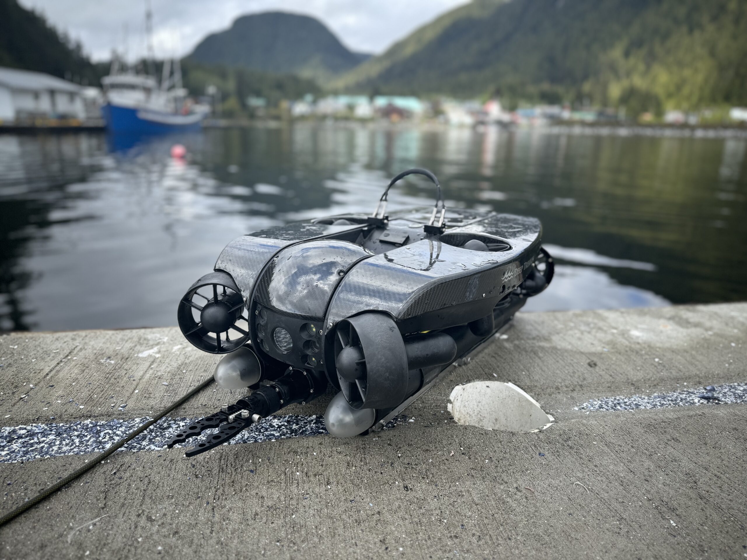
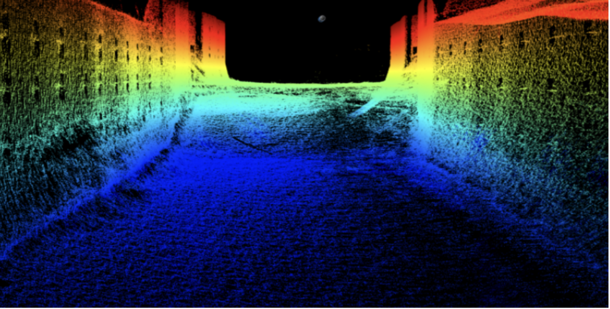
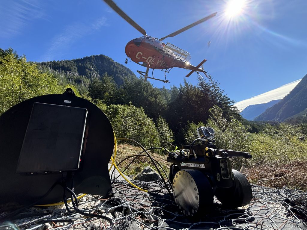
Remotely Operated Vehicle (ROV) Services involve the deployment of submersible robotic platforms equipped with high-definition cameras, sonar, and sensors to perform underwater inspections, surveys, and maintenance tasks in environments that are hazardous or inaccessible to divers. ROVs are ideal for inspecting intakes, outfalls, submerged pipelines, and reservoir structures with precision and safety.
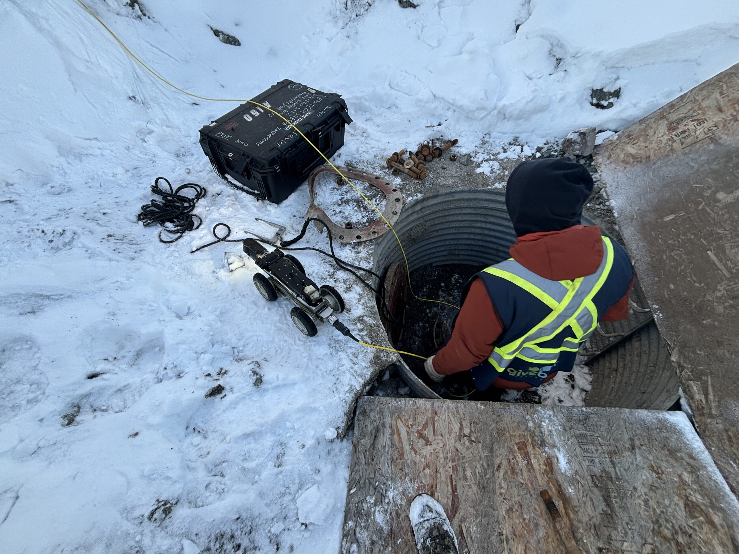
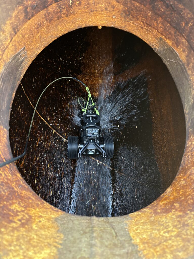
Pipe Crawler Services utilize tracked robotic systems to inspect the internal condition of submerged, buried, or hard-to-access pipelines ranging from 8” to 60” in diameter. Equipped with 4K video, laser profiling, and PACP reporting tools, these systems allow for trenchless assessments of stormwater, sewer, and industrial conduits without the need for confined space entry or excavation.
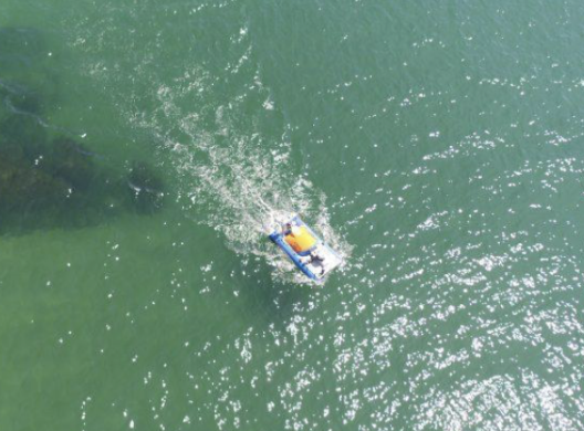
Unmanned Surface Vehicle (USV) and Autonomous Surface Vehicle (ASV) Services provide autonomous or remote-controlled surveying platforms designed for bathymetric, geophysical, and environmental data collection across lakes, rivers, harbors, and coastal areas. Outfitted with multibeam sonar, GPS, and onboard sensors, these systems are ideal for pre-dredging surveys, habitat assessments, and remote-access mapping operations.
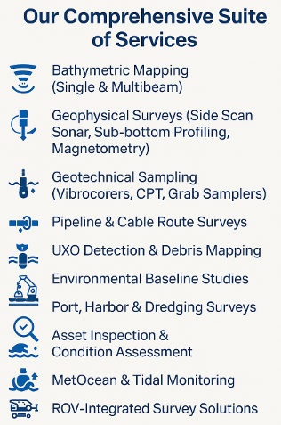
High-Resolution Bathymetric & 3D Surveys using ROVs, USVs, and multibeam sonar systems to deliver ultra-accurate depth, topographic, and volume data for coastal, inland, and subsea environments.
Geophysical Surveys leveraging side scan sonar, sub-bottom profilers, and magnetometers mounted on ROVs and USVs to detect buried pipelines, UXO, structural debris, and sediment layers with minimal surface disruption.
Geotechnical Surveying with vibrocorers, CPT units, and robotic samplers deployed via custom ROV and crawler platforms to analyze soil composition, strength, and bearing capacity for engineering and environmental design.
Pipe Survey Solutions using advanced tracked pipe crawlers equipped with 4K cameras, sonar, and NASSCO-certified reporting tools to inspect and map the internal condition of submerged and buried pipelines.
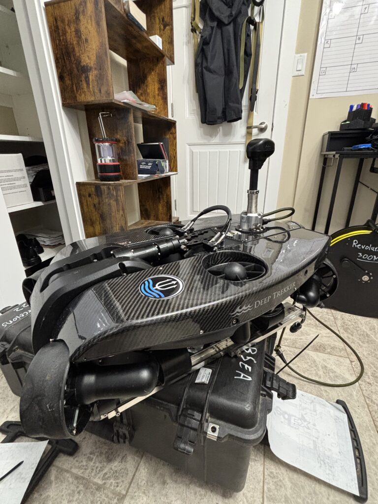
Our ROVs are optimized for subsea environments where visibility, precision, and safety are paramount. Key capabilities include:
Intake and Outfall Inspections (Potable and Industrial)
Fire Suppression Tank Surveys (NFPA 25) Robotic Services
High-Definition Sonar Mapping & Sediment Profiling
Structural Condition Assessments & NDT Integration
Digital Photogrammetry & Leak Detection Robotic Services
Technology Spotlight: Deep Trekker Revolution, DTG3 Expert, Photon, Pivot, SAAB, SEAMOR, Blueprint Oculus M750D Multibeam Sonar, Axsub HD DiveCam Systems
Our tracked pipe crawlers navigate horizontal pipelines from 4″ to 60″ diameter, including submerged and fully flooded systems. Key applications:
Trenchless Internal Inspections (Storm, Sewer, Industrial)
Potable Pipeline Assessment (AWWA C651/652 standards)
PACP-Certified Defect Coding & Reporting Robotic Services
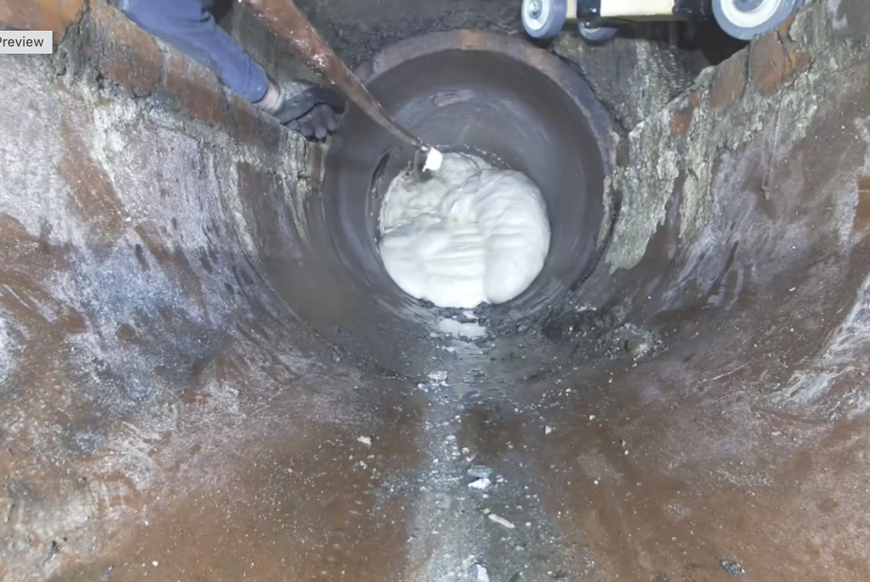
Remote Foam Injection for Abandonment or Sealing
Sediment Thickness Mapping and Pre-Cleaning Surveys
Available Add-Ons: Laser ring profiling, HD pan-tilt zoom cameras, 360° pipe head rotation, NASSCO PACP export
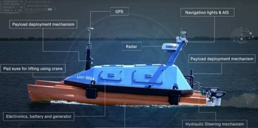
Our Unmanned Surface Vehicles (USVs) and Autonomous Surface Vehicles (ASVs) enable autonomous and remote hydrographic and geophysical surveying in environments ranging from remote lakes to active harbors.
Core applications include: Robotic Services
High-Resolution Bathymetric Mapping
Sub-Bottom Profiling & Side Scan Sonar
Turbidity & NTU Data Logging
Pre/Post Dredging Validation
Environmental Impact Assessments
Each platform is equipped with GPS, RTK GNSS, echosounders, and sonar payloads customizable to project scope and depth requirements.
Engineered for vertical and overhead ferrous surfaces, our magnetic crawlers are ideal for inspecting:
Water Towers, Steel Tanks & Caissons
Structural Steel Piles & Wharf Caissons
Ship Hull Inspections and Coating Surveys
UT Thickness Mapping & Real-Time Video Feed
These robots are perfect for tank entry alternatives, reducing confined space exposure while delivering detailed wall condition reports.
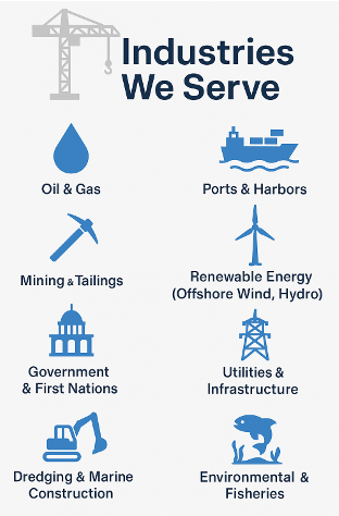
Our robotic inspection and survey capabilities are trusted by clients across multiple sectors:
Municipal Utilities & Districts: Reservoir, tank, and distribution system inspections
Oil & Gas Operators: Subsea pipeline, valve, and riser inspections
Mining & Heavy Industry: Raw water intake, clarifier tank, and tailings pond assessments
Ports, Harbors & Marine Terminals: Bathymetric surveys, berth clearance, and structure inspection
Environmental Agencies: Habitat impact studies, sedimentation analysis, and regulatory compliance
First Nations & Remote Communities: Turnkey inspection solutions with portable, low-footprint systems
Engineering & Construction Firms: Pre-construction baseline data, as-built confirmation, and QA/QC verification


✔ Municipal & Public Utilities
We assist municipalities, regional districts, and water authorities with potable water reservoir inspections, sewer and stormwater mapping, and asset condition assessments—fully compliant with AWWA, NFPA 25, and CSA standards.
✔ Oil & Gas
Our team supports upstream, midstream, and downstream operations with subsea pipeline surveys, outfall inspections, IMR programs, and offshore infrastructure mapping, aligned with API and industry HSE protocols.
✔ Marine Construction & Engineering
From pre-construction geophysical and geotechnical surveys to as-built documentation and UXO clearance, we serve marine contractors, engineers, and EPCs with actionable data and real-time visuals.
✔ Environmental & Regulatory Agencies
We provide baseline environmental studies, tidal monitoring, and sediment sampling to support habitat protection, permitting, and ongoing compliance with regulatory frameworks.
✔ Ports, Harbors & Dredging Authorities
Our bathymetric mapping, debris detection, and structural inspections help port authorities and dredging contractors manage safe navigation, capital projects, and maintenance cycles.
✔ Mining, Pulp & Paper, and Heavy Industry
We support industrial clients with underwater inspections of intakes, outfalls, raw water systems, and emergency response scenarios, tailored for remote or restricted-access sites.
✔ Indigenous & Remote Communities
We offer cost-effective ROV and diver-based solutions for water infrastructure, intake cleaning, and leak detection in challenging or logistically isolated regions.
Whether you’re a municipality seeking a non-invasive water tank inspection or an energy provider managing remote marine infrastructure, Ven-Tech Subsea has a robotic solution engineered for your needs.
Get in touch to schedule a project consultation, request a live demo, or explore how our technology can streamline your asset management and compliance strategy.