Ven-Tech Subsea proudly offers cutting-edge UAV bathymetric LiDAR mapping services, delivering high resolution, accurate, and efficient survey data for coastal, marine, and inland waterway applications. Our aerial LiDAR system captures detailed seafloor and submerged topography data with the precision and speed required for engineering, environmental, and infrastructure projects.

Green Laser Bathymetry: Can penetrate water and map submerged terrain continuously, delivering both above-water topography and underwater bathymetry in one pass.
High Precision & Accuracy: 3 cm precision (≈1.2 in), with similar accuracy; field-tested performance ensures reliable results for engineering and survey grade needs.
Extended Flight Autonomy: Up to ~45 minutes of flight time per battery, enabling large area coverage with fewer takeoffs/landings.
High Shot Density & Rapid Scanning: Up to 20,000 shots per second, scanning at ~50 Hz; multiple echoes (up to 10 per shot); 40° field of view.
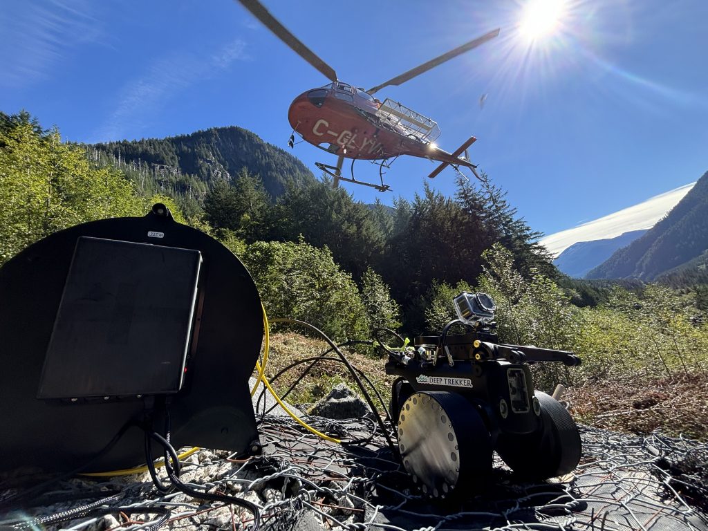
Multi-Platform Compatibility: Designed for drones (multirotor or helicopter UAVs) via quick-release adapters; lightweight (~3.7 kg excluding battery) to support versatility
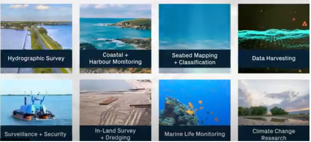
Our bathymetric UAV LiDAR service is perfect for:
Coastal & Shoreline Mapping — monitoring erosion, mapping intertidal zones, beach replenishment projects.
River, Lake & Reservoir Surveys — measuring depth, sediment buildup, shoals, and hydraulic structure condition.
Submerged Structure Inspections — dams, intakes, water treatment infrastructure.
Dredging & Marine Works — pre/during/post dredging bathymetric profiles, scour detection.
Environmental & Habitat Studies — mapping aquatic vegetation, benthic habitats, underwater archaeology.
Floodplain & Hydraulic Modeling — acquiring data in shallow water areas where boat surveys are costly or difficult.
Up to 100m/ 330ft
3cm/ 1.2"
3cm/ 1.2"
Detailed bathymetric and topographic point clouds with sub-centimetre precision
-Detailed bathymetric and topographic point clouds with sub-centimetre precision
-Georeferenced terrain models (DTMs) combining land and underwater surfaces
-High-resolution orthophotos or colorized data (with embedded camera imagery)
-Digital elevation models (DEMs) and depth maps for engineering, design, or environmental compliance
-Full survey reports including methodology, QA/QC data, water clarity (Secchi or turbidity equivalent), flight logs, data processing summary
Bathymetric LiDAR & UAV Seafloor Mapping Services
Safety and regulatory adherence are foundational to our operation:
-Fully certified pilots/operators (UAV regulatory compliance) and mapped with safety planning for water operations
-Operate in daylight, favorable weather and water clarity (typically water clarity up to ~2 Secchi depths for effective penetration)
-Laser classification and safety protocols in place (Class 3B laser systems, ocular hazard zone considered)
-Environmental protection: minimal disturbance, no waterborne vessels required for many surveys.

Our Geophysical Survey Services capabilities are trusted by clients across multiple sectors:
Municipal Utilities & Districts: Reservoir, tank, and distribution system inspections
Oil & Gas Operators: Subsea pipeline, valve, and riser inspections
Mining & Heavy Industry: Raw water intake, clarifier tank, and tailings pond assessments
Ports, Harbors & Marine Terminals: Bathymetric surveys, berth clearance, and structure inspection
Environmental Agencies: Habitat impact studies, sedimentation analysis, and regulatory compliance
First Nations & Remote Communities: Turnkey inspection solutions with portable, low-footprint systems
Engineering & Construction Firms: Pre-construction baseline data, as-built confirmation, and QA/QC verification


-Deep experience in underwater, shoreline, and infrastructure surveying
-Full turn-key service: mobilization, flight, data capture, processing, analysis, reporting
-High quality gear and redundant data training protocols (data validation, calibration certificates, QA/QC)
-Certified and insured; audited safety, regulatory and quality systems
-Projects delivered on time with clarity in cost, schedule, and deliverables
Whether you’re a municipality seeking a non-invasive water tank inspection or an energy provider managing remote marine infrastructure, Ven-Tech Subsea has a robotic solution engineered for your needs.
Get in touch to schedule a project consultation, request a live demo, or explore how our technology can streamline your asset management and compliance strategy.