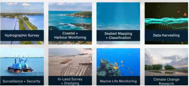
At Ven-Tech Subsea, we offer cutting-edge Geophysical Survey Services using high-resolution marine instrumentation to unlock detailed insights below the seabed. From sub-bottom profiling and side scan sonar to magnetometry and bathymetric mapping, we deliver accurate, actionable subsurface data for design, construction, remediation, and permitting.
Our team supports projects across marine construction, offshore energy, UXO detection, port development, and underwater asset mapping—from shoreline to deepwater environments.
A geophysical survey uses remote sensing tools to characterize and interpret physical features beneath or on the seafloor. At Ven-Tech Subsea, we deploy sensor systems via vessel, USV, or ROV to create 2D and 3D models of:
Seabed structure & composition
Subsurface sediment layers
Man-made objects (pipelines, debris, UXOs)
Geological anomalies
Magnetically responsive targets
All data is post-processed and interpreted by qualified marine geophysicists and delivered in CAD, GIS, and regulatory-ready formats.
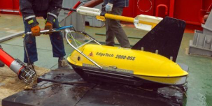
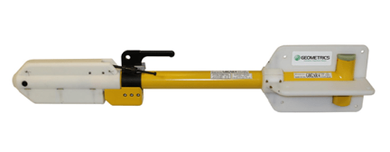
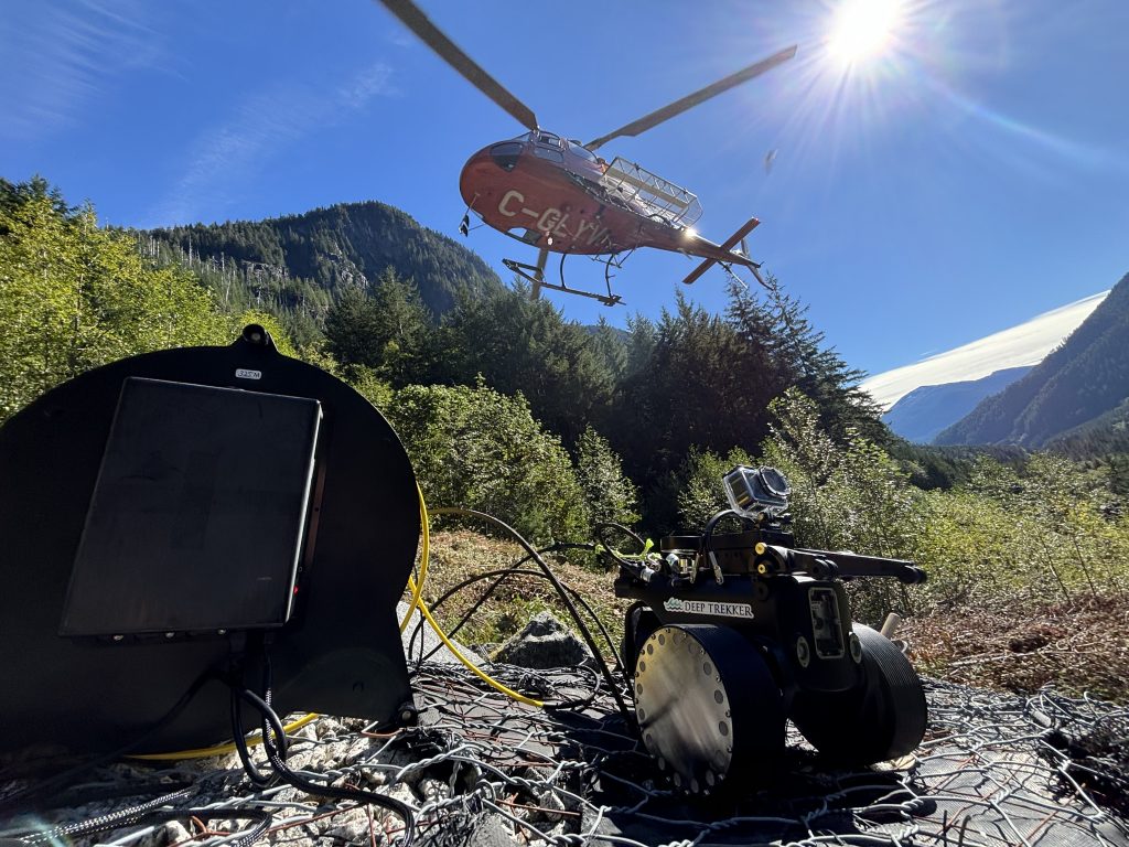
Geophysical surveys using marine magnetometers and EM sensors mounted on ROVs, USVs, or AUVs to detect ferrous objects, UXO, buried pipelines, and structural debris. Ideal for archaeological investigations, pipeline clearance, and utility mapping in complex underwater environments.
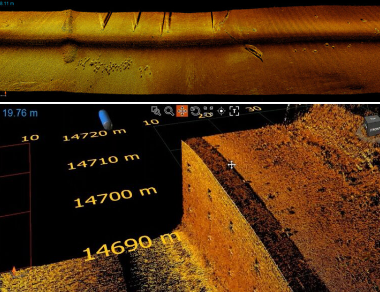
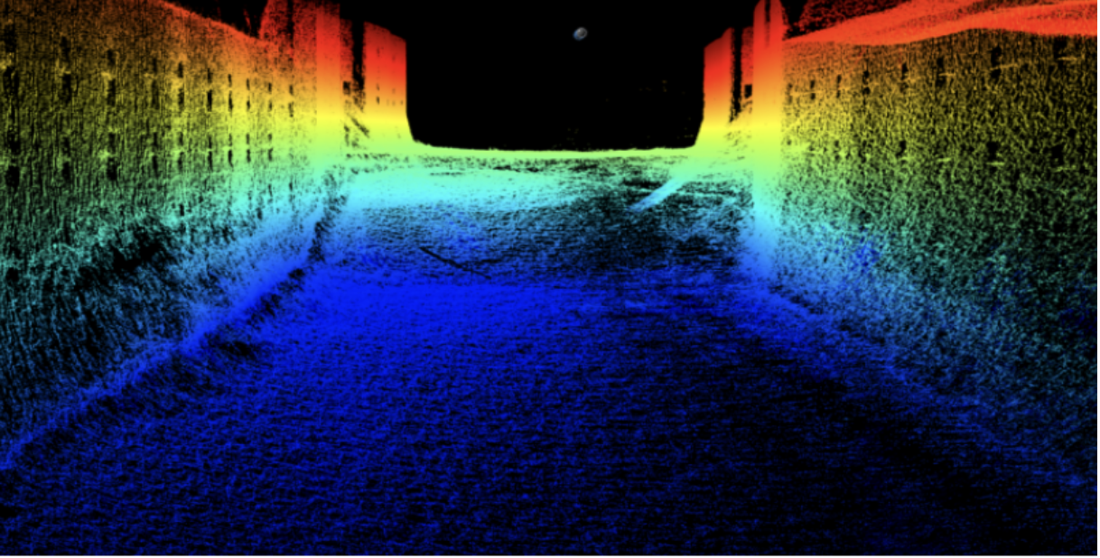
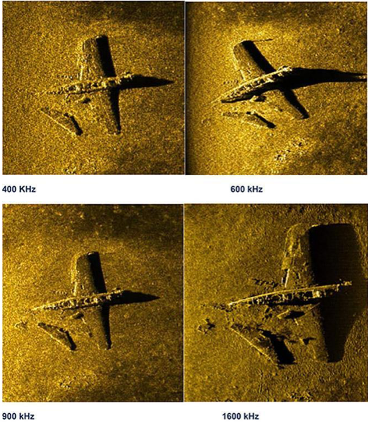
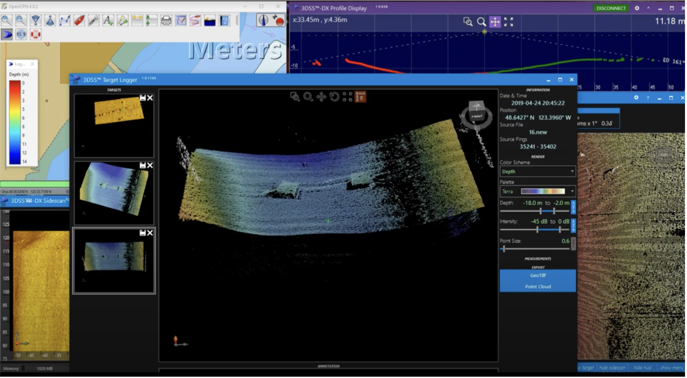
High-resolution side scan sonar surveys deliver detailed seafloor imagery, enabling the identification of submerged infrastructure, wrecks, debris, scour zones, and anchor hazards. Data is georeferenced with RTK GPS for precise positioning and integrated with bathymetric charts and GIS.
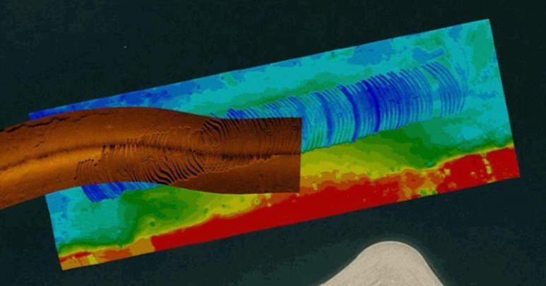
Sub-bottom profilers reveal sediment stratification, depth to bedrock, and buried features. Our systems support site characterization for dredging, foundation design, environmental permitting, and outfall siting — providing accurate cross-sectional data without intrusive coring.
Geophysical classification of seafloor material types using sonar reflectivity, backscatter data, and integrated geotechnical samples. Supports engineering feasibility, habitat assessments, anchoring analysis, and marine construction planning with minimal surface disturbance.
Get a full picture above and below the seafloor in a single deployment.
Capture both the surface texture and the sub-seafloor profile in one pass.
For detailed seafloor imaging and target identification.
See what lies beneath the sediment.
For detection of ferrous materials, pipelines, UXOs, and wrecks.
Our geophysical survey outputs are meticulously engineered to support regulatory permitting, engineering design, and stakeholder decision-making. Every deliverable is generated with full QA/QC oversight, geo-referenced accuracy, and formatted to integrate seamlessly with GIS, CAD, and BIM platforms.
Deliverables include:
Sub-Bottom Stratigraphic Cross-Sections
High-resolution seismic interpretations detailing sediment layers, depth to refusal, and geotechnical horizons.
Acoustic Sonar Mosaics
Georeferenced side scan sonar mosaics for seabed feature identification, scour analysis, and anomaly detection.
Bathymetric Digital Elevation Models (DEMs)
Ultra-accurate 3D terrain models of seafloor morphology, supporting dredging, construction, and habitat assessments.
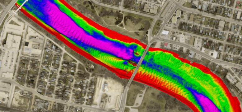
Magnetometer Heat Maps
Detailed magnetic intensity maps used to identify ferrous targets, UXO risk zones, buried pipelines, and debris fields.
Geophysical Anomaly Reports
Categorized reports summarizing sonar, magnetic, and sub-bottom anomalies with annotated findings and risk ranking.
Multi-Format Data Exports
CAD (DXF), GIS (SHP), point cloud (LAS), and formatted reports (PDF) for direct use in design, modeling, and regulatory submissions.
Comprehensive QA/QC + Technical Interpretation Package
Full data validation, metadata records, and geophysical interpretations prepared by experienced survey professionals.
Our Geophysical Survey Services capabilities are trusted by clients across multiple sectors:
Municipal Utilities & Districts: Reservoir, tank, and distribution system inspections
Oil & Gas Operators: Subsea pipeline, valve, and riser inspections
Mining & Heavy Industry: Raw water intake, clarifier tank, and tailings pond assessments
Ports, Harbors & Marine Terminals: Bathymetric surveys, berth clearance, and structure inspection
Environmental Agencies: Habitat impact studies, sedimentation analysis, and regulatory compliance
First Nations & Remote Communities: Turnkey inspection solutions with portable, low-footprint systems
Engineering & Construction Firms: Pre-construction baseline data, as-built confirmation, and QA/QC verification


Multidisciplinary Robotic Fleet: We deploy a robust line of robotic platforms engineered for maximum adaptability. From narrow pipelines to deep-water inspections and ferrous surface mapping, our systems are purpose-built for versatility.
Safety First, Always: Our robotic methods minimize or eliminate confined space entry, underwater diver deployment, and high-risk manual procedures. This translates into safer job sites, fewer liabilities, and more efficient project delivery.
Regulatory Excellence: We operate under rigorous standards and industry frameworks, including full CSA compliance, WorkSafe BC confined space protocols, and certified potable water procedures. CSA Confined Space Standard Z1006 | WorkSafe BC Confined Space Guidelines
Integrated Data Collection & Reporting: With 4K video capture, multibeam sonar, UT thickness gauging, and photogrammetry, our robotic services offer actionable data formatted into professional, standards-compliant reports for decision-makers.
Proprietary ATHENA™ Support: Every deployment is managed through ATHENA™—our AI-powered compliance and analytics system that logs, tracks, and archives every operational detail for full transparency and audit-readiness
Whether you’re a municipality seeking a non-invasive water tank inspection or an energy provider managing remote marine infrastructure, Ven-Tech Subsea has a robotic solution engineered for your needs.
Get in touch to schedule a project consultation, request a live demo, or explore how our technology can streamline your asset management and compliance strategy.