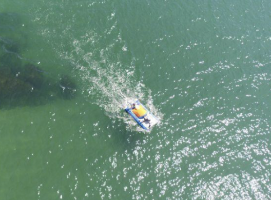
Ven-Tech Subsea offers a full suite of Unmanned Surface Vessels (USV) services designed for smarter, safer, and more efficient marine operations. Whether you’re conducting detailed hydrographic surveys, monitoring environmental conditions, inspecting submerged infrastructure, or operating in hazardous environments—our USV fleet delivers precision results with zero onboard risk.
From shallow inland waterways to deep offshore zones, our autonomous platforms reduce human exposure, cut operational costs, and deliver high-resolution, real-time data that accelerates decision-making.
Ven-Tech’s Unmanned Surface Vessels (USV) are ideal for:
Hydrographic surveys (multibeam/single beam)
Sub-bottom profiling & seabed stratigraphy
Environmental & oceanographic data collection
Cable & pipeline route tracking
Asset surveillance & perimeter patrols
Oil spill & slick detection
Harbor, port, and dredge surveys
UXO detection & debris mapping
Long-range offshore missions
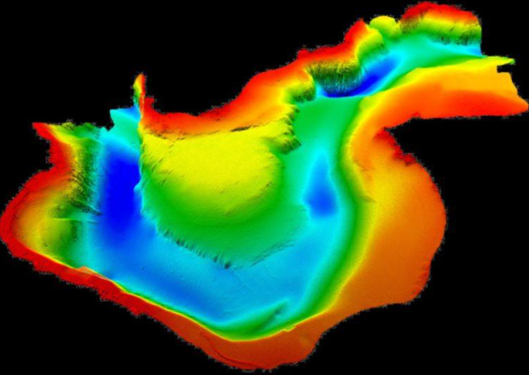
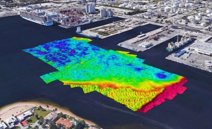
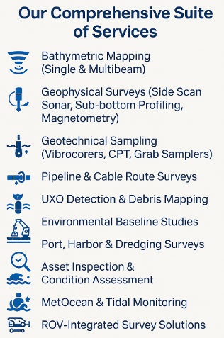
Hydrographical Survey Services involve the precise measurement and mapping of underwater topography, water depth, and seabed features to support safe navigation, infrastructure planning, and marine construction.
Geophysical Survey Services involve the use of advanced sonar and sensor technologies to detect, map, and analyze subsurface conditions, sediment layers, and buried objects for engineering, environmental, and construction applications.
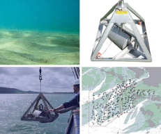
Geotechnical Survey Services involve the sampling and analysis of seabed and subsurface materials using tools like vibrocorers, CPT, and grab samplers to assess soil strength, composition, and stability for engineering and marine infrastructure design.
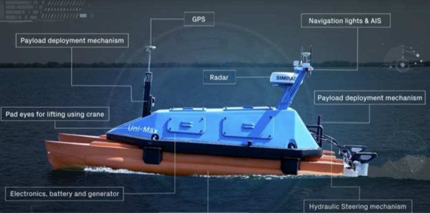
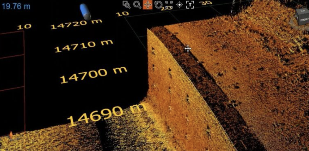
USVs equipped with high-resolution multibeam echosounders and RTK GNSS systems perform autonomous hydrographic surveys to map coastal, inland, and offshore water bodies with exceptional precision. Ideal for shallow, hazardous, or restricted zones, these platforms deliver safe, high-density data collection without requiring onboard personnel.
Unmanned Surface Vessels outfitted with side scan sonar, magnetometers, and sub-bottom profilers provide advanced geophysical profiling for subsurface analysis. These surveys detect buried structures, pipelines, UXO, and sediment stratification layers with minimal environmental disturbance — supporting pipeline routing, dredging, and environmental assessments.
USV platforms integrate automated sensors for NTU, pH, dissolved oxygen, chlorophyll, and temperature to conduct real-time water quality monitoring. Combined with water sampling systems and telemetry, they support environmental compliance, baseline monitoring, and effluent plume tracking in both regulated and remote environments.
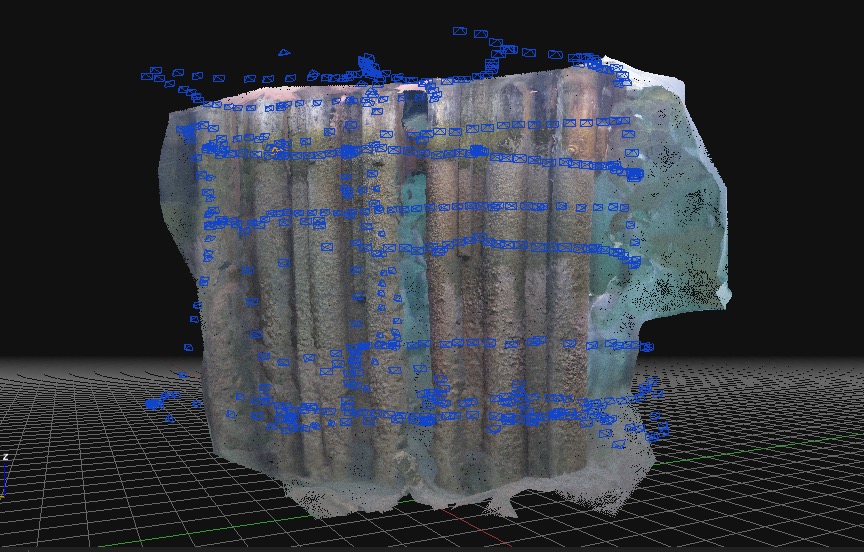
Our USV fleet supports pipeline inspections, bridge pier assessments, and other submerged asset evaluations using forward-looking sonar, 4K cameras, and positioning systems. These missions are ideal for initial screening, low-visibility locations, and environments where diver entry or vessel-based survey is restricted or hazardous.
Ven-Tech Subsea provides end-to-end mission logistics, including:
-Remote launch from shore, vessel, or dock
-Real-time navigation via 4G, RF, or satellite uplink
-Web-based dashboards for live mission tracking
-Optional: On-site technician or remote ops center integration
-ROV, diver, and sonar system integration available
No onboard personnel: Operate in dangerous, contaminated, or remote zones
Lower cost: Reduced mobilization, crew, and fuel expenses
Rapid deployment: Shippable, scalable platforms deploy in <48 hours
Integrated operations: Combine with ROVs, divers, pipe crawlers, and sensors
High endurance: Multi-day autonomy with reliable navigation systems
Data confidence: Real-time quality control and continuous data stream

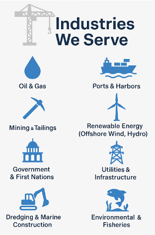
✔ Municipal & Public Utilities
We assist municipalities, regional districts, and water authorities with potable water reservoir inspections, sewer and stormwater mapping, and asset condition assessments—fully compliant with AWWA, NFPA 25, and CSA standards.
✔ Oil & Gas
Our team supports upstream, midstream, and downstream operations with subsea pipeline surveys, outfall inspections, IMR programs, and offshore infrastructure mapping, aligned with API and industry HSE protocols.
✔ Marine Construction & Engineering
From pre-construction geophysical and geotechnical surveys to as-built documentation and UXO clearance, we serve marine contractors, engineers, and EPCs with actionable data and real-time visuals.
✔ Environmental & Regulatory Agencies
We provide baseline environmental studies, tidal monitoring, and sediment sampling to support habitat protection, permitting, and ongoing compliance with regulatory frameworks.
✔ Ports, Harbors & Dredging Authorities
Our bathymetric mapping, debris detection, and structural inspections help port authorities and dredging contractors manage safe navigation, capital projects, and maintenance cycles.
✔ Mining, Pulp & Paper, and Heavy Industry
We support industrial clients with underwater inspections of intakes, outfalls, raw water systems, and emergency response scenarios, tailored for remote or restricted-access sites.
✔ Indigenous & Remote Communities
We offer cost-effective ROV and diver-based solutions for water infrastructure, intake cleaning, and leak detection in challenging or logistically isolated regions.
Choosing us means working with a partner that’s more than a contractor—we’re your marine data ally. Here’s what sets us apart:
— Access to elite survey equipment (without capital cost)
— CSA/ADCI-certified commercial diving & ROV support
— Fast mobilization across Canada & the U.S.
— Data integrity through strict QA/QC workflows
— Multi-industry expertise: energy, utilities, infrastructure, and ports
— BCCSA COR Certified | ISNetworld | Avetta | Cognibox