Ven-Tech Subsea is redefining the future of underwater inspections. As the first and only commercial diving and ROV company on the West Coast of Canada offering Advanced ROV Photogrammetry, we are delivering next-generation data and visualization solutions that replace traditional inspections with precise, measurable, and actionable 3D digital models—without ever sending a diver into harm’s way.
Whether you’re inspecting municipal infrastructure, marine structures, or high-risk industrial assets, Ven-Tech Subsea’s ROV Photogrammetry service provides true-to-scale, millimetre-accurate digital twins of submerged environments, enabling smarter decisions, enhanced compliance, and reduced costs.
WHY CLIENTS CHOOSE ROV 3D PHOTOGRAMMETRY
✅ CAD-Ready Deliverables — Eliminate subjectivity with interactive, measurable 3D models ready for engineering, asset management, and permitting.
✅ Non-Destructive & Contactless — Ideal for sensitive ecosystems, potable water systems, and confined spaces.
✅ No Downtime Required — Inspections performed live, without draining, shutdowns, or operational interruptions.
✅ Improved Safety — No diver entry. No confined space risk. No H2S exposure.
✅ Fewer Mobilizations — Reduce overall inspection and re-entry costs by consolidating all data in one mobilization.
✅ Remote Collaboration — Share inspection results securely via cloud-based 3D viewer portals.
✅ Regulatory-Grade Documentation — All outputs are aligned with CSA, AWWA C652-19, NFPA 25, NASSCO, and WorkSafeBC standards.
Municipal Water & Utilities: Potable and fire reservoir inspections (AWWA C652-19, NFPA 25 compliant) | Stormwater and wastewater system modeling | Outfall integrity, sediment tracking, confined space mapping
Oil & Gas Infrastructure: Subsea pipelines, risers, manifolds, and mooring systems | FPSO hull mapping and weld inspection | Caisson scour detection and structural monitoring
Marine & Offshore Structures: Piers, bulkheads, bridge footings, and seawalls | Foundations, pilings, anchor systems | Port & terminal underwater infrastructure assessments
Environmental & Habitat Mapping: Artificial reef modeling and topographic surveys | Biodiversity monitoring and aquaculture net pen mapping | Erosion documentation and sediment migration modeling
Whether you’re planning capital repairs, filing permits, or managing critical infrastructure — our ROV photogrammetry services provide the visibility, traceability, and defensible data your team needs to act with confidence.

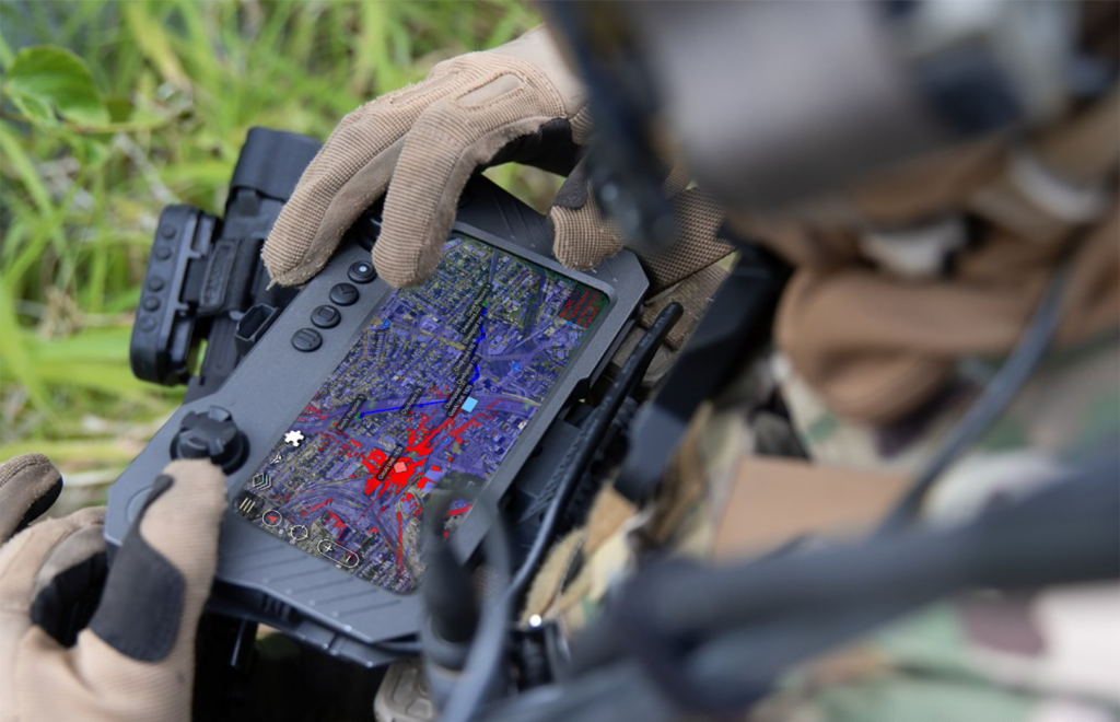
All of Ven-Tech Subsea’s photogrammetry missions are powered by ATHENA™, our proprietary Artificial Tactical HSE Engineering & Navigation Assistant. ATHENA supports every inspection with:
• Customized risk modeling
• Regulatory compliance automation
• Confined space entry avoidance
• Procedure generation aligned with CSA, DCBC, and WorkSafeBC
• Full audit trails and documentation linked to asset lifecycle management
ATHENA ensures your inspection is planned safer, delivered smarter, and fully documented to meet every compliance standard.
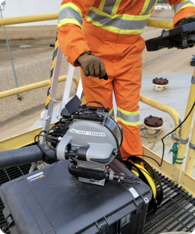
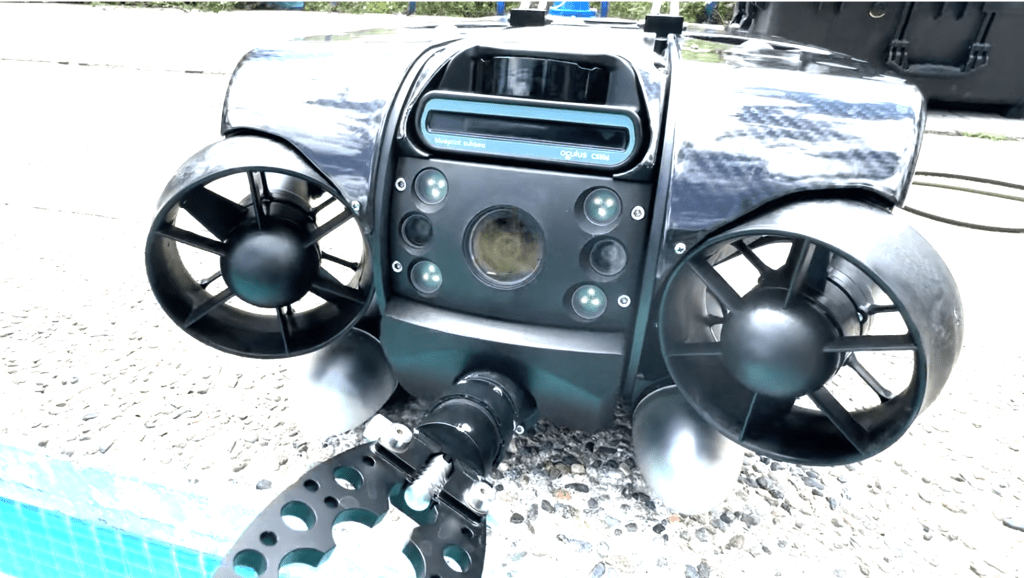
This process is entirely remote-controlled, highly repeatable, and suitable for any submerged environment, including potable water reservoirs, marine assets, outfalls, stormwater lines, tanks, or pipelines.
Ven-Tech Subsea deploys Advanced ROVs equipped with 4K UHD cameras, multibeam sonar, and structured lighting to collect hundreds or thousands of high-resolution overlapping images. These image sets are processed using industry-leading photogrammetry software to generate hyper-accurate 3D mesh models of the submerged structure.
This process is entirely remote-controlled, highly repeatable, and suitable for any submerged environment, including potable water reservoirs, marine assets, outfalls, stormwater lines, tanks, or pipelines.
✅ True-to-Scale 3D Digital Twin Models
✅ Mesh Models with Accurate Geometry & Texture
✅ CAD-Compatible Formats (.OBJ, .DXF, .LAS)
✅ Interactive Web-Based 3D Viewer Access
✅ Detailed Condition Reports with Annotations
✅ Defect Tagging (corrosion, cracks, biofouling, etc.)
✅ Volume, Distance & Area Measurements
✅ Comprehensive PDF Report Summary
✅ Geospatial Accuracy with Sonar & GPS Overlay
Get the data your team actually needs. Ven-Tech Subsea’s ROV Photogrammetry Services give you a permanent, measurable, navigable record of your underwater assets—without downtime, guesswork, or risk.
Ven-Tech Subsea — Powered by ATHENA™
The Future of Underwater Inspection is Here.
Major Oil & Gas Operator – Remote Processing Facility, Northern Alberta
Structural integrity assessment of a submerged intake manifold and connecting pipeline located within a remote Arctic-adjacent oil processing site. The asset was located in a contaminated, low-visibility environment, previously accessible only through confined space entry and high-risk dive operations.
Traditional diver-based inspections posed significant safety hazards due to H2S exposure potential, delta-P risk, and extreme weather conditions. The client required detailed visual inspection data and CAD-compatible measurements for maintenance planning — without shutdown or manned entry.
en-Tech Subsea deployed its Revolution ROV system equipped with ultra-high-resolution 4K cameras and structured lighting, integrated with ATHENA™ for pre-mission planning and regulatory alignment. The entire inspection was performed via robotic photogrammetry, capturing thousands of geo-tagged images and sonar overlays.
• A CSA Z275.2-compliant remote work procedure & exposure control strategy • A logistical plan for sub-zero mobilization and real-time remote collaboration with the client’s engineering team
• A fully measurable 3D digital twin of the manifold and pipe structure, delivered in CAD and web-viewer formats • Zero confined space entry, no production interruption, and complete data acquisition in 8 hours • Saved the client over $250,000 in operational downtime and eliminated high-risk human entry
• A fully measurable 3D digital twin of the manifold and pipe structure, delivered in CAD and web-viewer formats “Ven-Tech’s photogrammetry solution gave us engineering-grade visuals we never thought possible — and the fact that it was done without shutting anything down or putting anyone at risk? Game changer.” • Saved the client over $250,000 in operational downtime and eliminated high-risk human entry